Thesis
Giacomo Ortenzi
Tesi di Laurea Prima Facoltà di Architettura Ludovico Quaroni, Università di Roma “La Sapienza”
Relatore: Prof. Marcello Pazzaglini
Correlatore: Prof. Loris Rossi
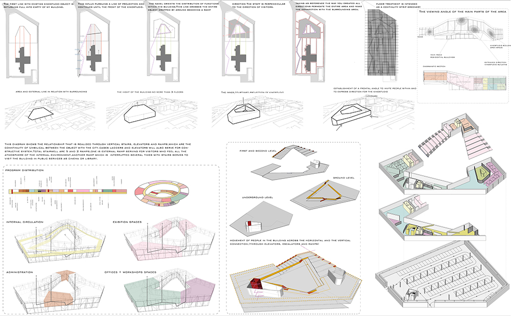
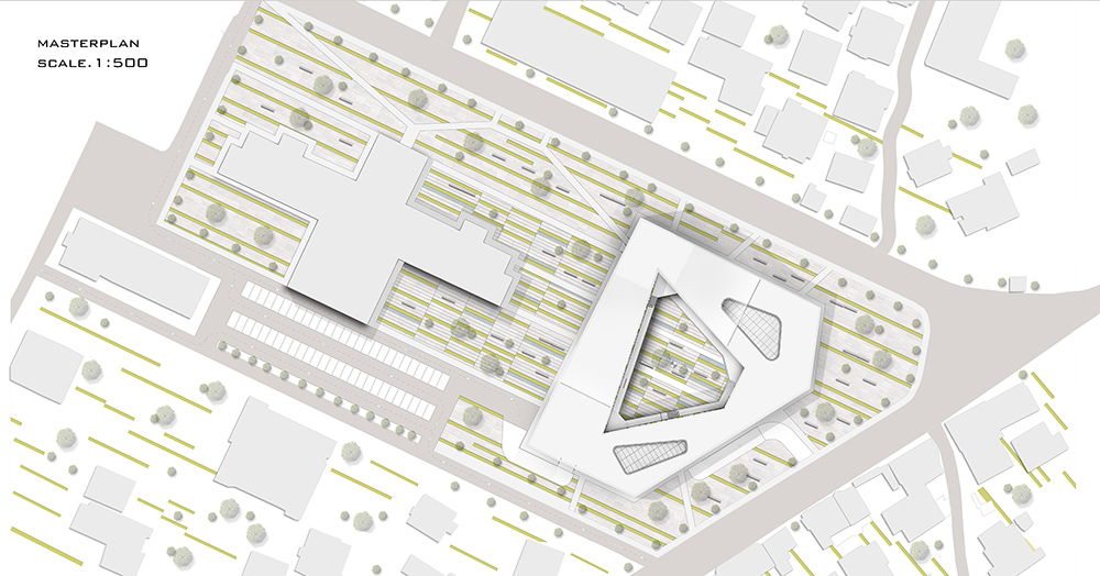
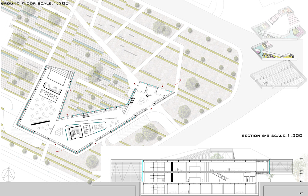
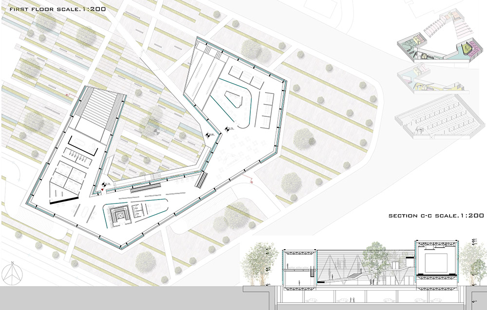
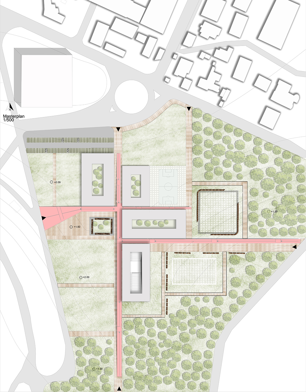
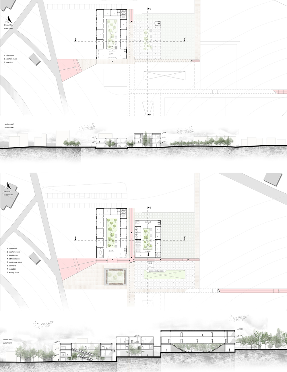
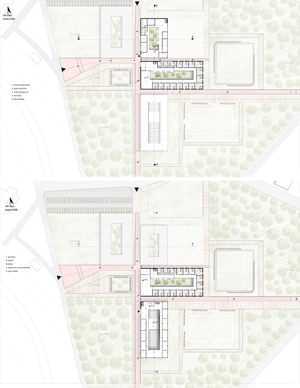
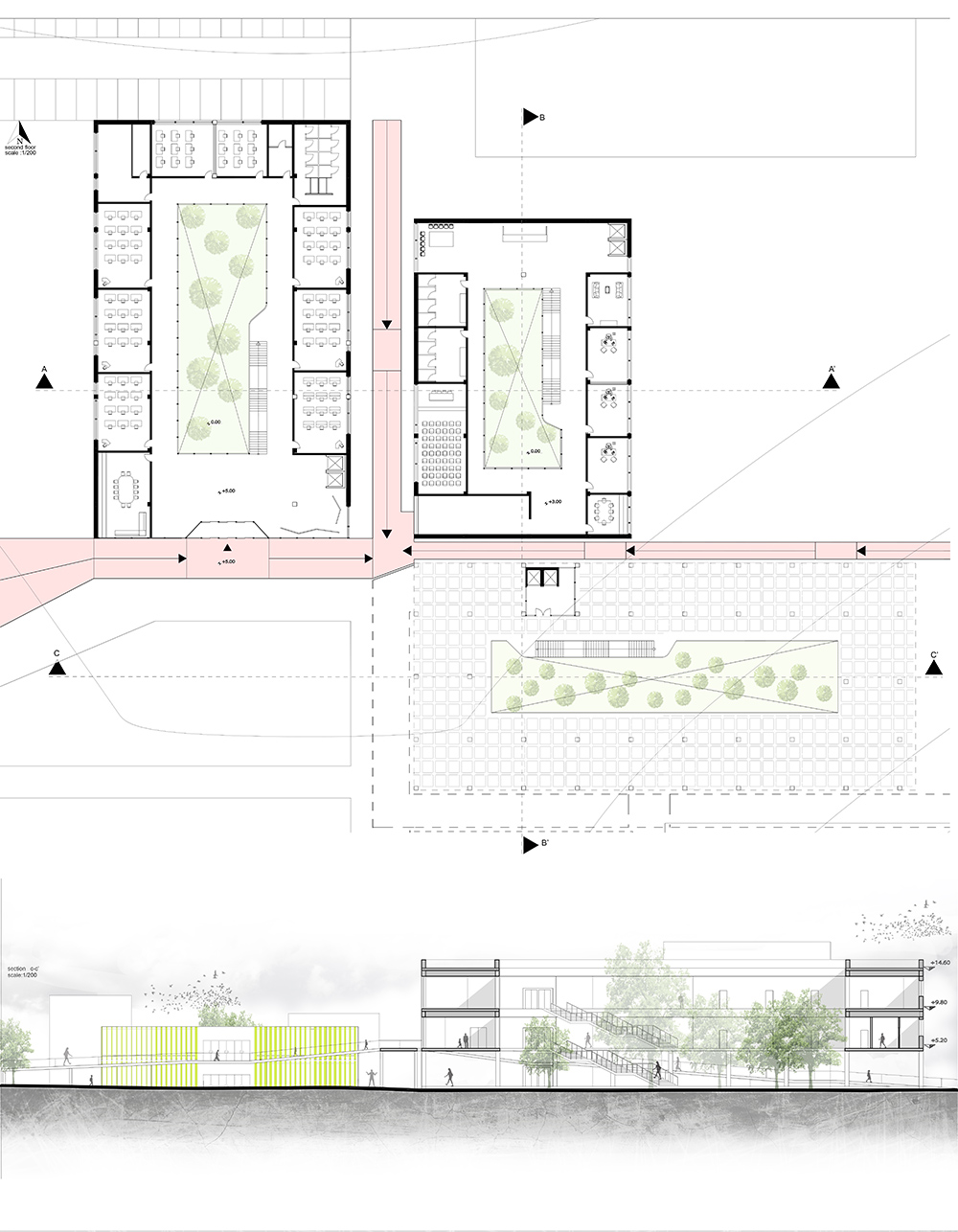
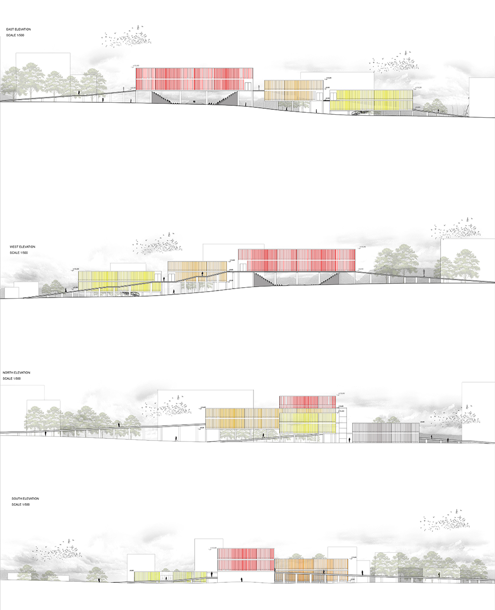
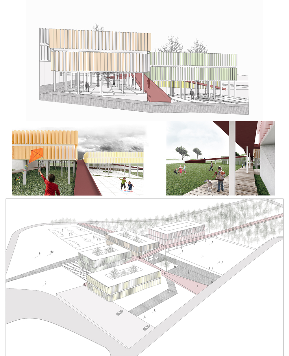
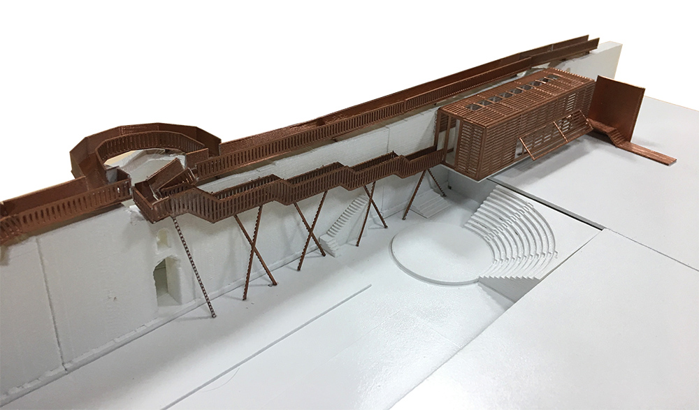
CP(p)O_ Centro di preparazione Olimpica per la Vela

CP(p)O_Centro di preparazione Olimpica per la Vela
“In other design fields, however, design space is conceived as an environment of force and motion rather than as a neutral vacuum. In naval design, for example, the abstract space of design is imbued with the properties of flow, turbulence, viscosity, and drag so that the form of a hull can be conceived in motion through water.”
Animate Form Greg Lynn Princeton Architectural Press, 1999.
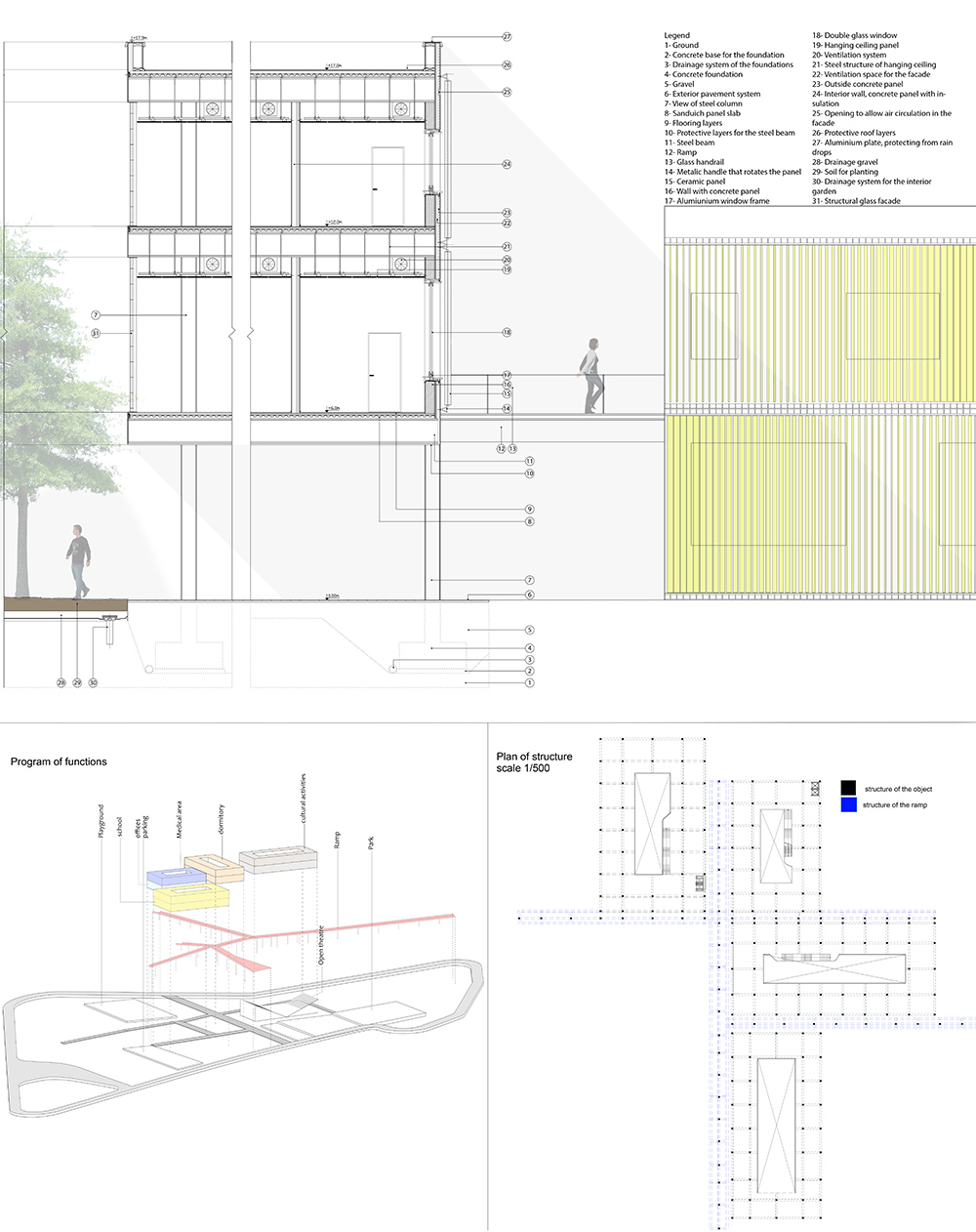
Partendo da questa affermazione di G.Lynn ho analizzato le forze che compongono l’ambiente marino; il risultato della loro azione sulla superficie dell’acqua è quello di generare delle increspature. Partendo da questo concetto e mediante la sua scomposizione diagrammatica, ho ricreato l’effetto dell’acqua (sotto l’influenza di vento e corrente) sulla copertura dell’edificio trasformandola e trattandola come una membrana osmotica, movimento di fluida tettonicità che racchiude l’edifico in un diaframma marino.
Per fare ciò, il diaframma è diventato sia camera d’aria, sia caleidoscopio di luce sia identificatore spaziale assumendo anche una chiara funzione bioclimatica: d’inverno come strato d’aria isolante e d’estate come superficie ventilata per l’aereazione naturale e forzata degli ambienti interni; al di sotto vi sono un mondo e uno spazio che guardano all’ambito nautico e velico organizzando e assolvendo quelle funzioni peculiari a un centro di questo tipo.
Leggi l’Articolo sul recupero delle imbarcazioni dismesse.


Costruisci la tua Copertura!
Stampa le immagini qui sotto, ritaglia le varie parti, piega i lembi bianchi e incollali!


Carmela Iannibelli
Tesi di Laurea Prima Facoltà di Architettura Ludovico Quaroni, Università di Roma “La Sapienza”
Relatore: Prof. Marcello Pazzaglini
Correlatore: Prof. Loris Rossi
Centro per il tempo libero sul Tevere
Roma: 2008
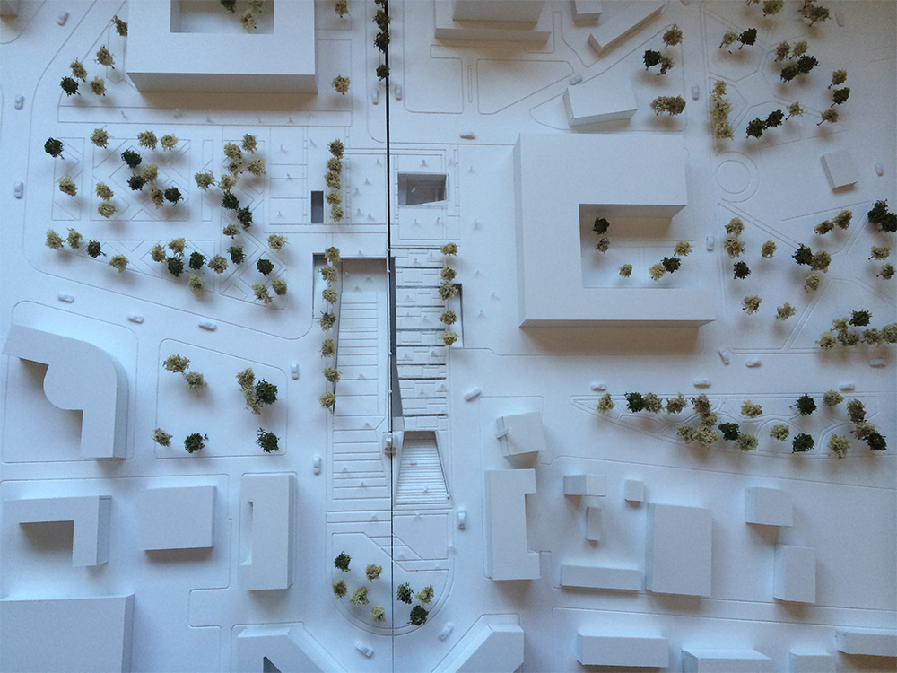
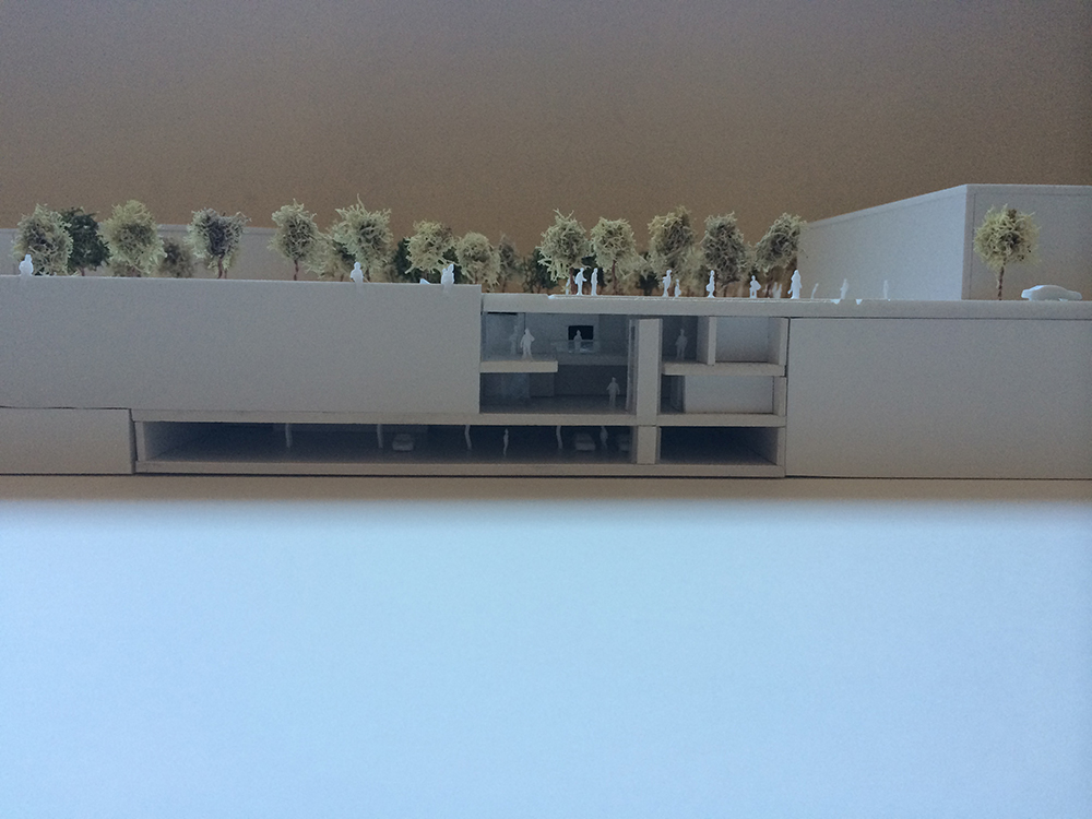
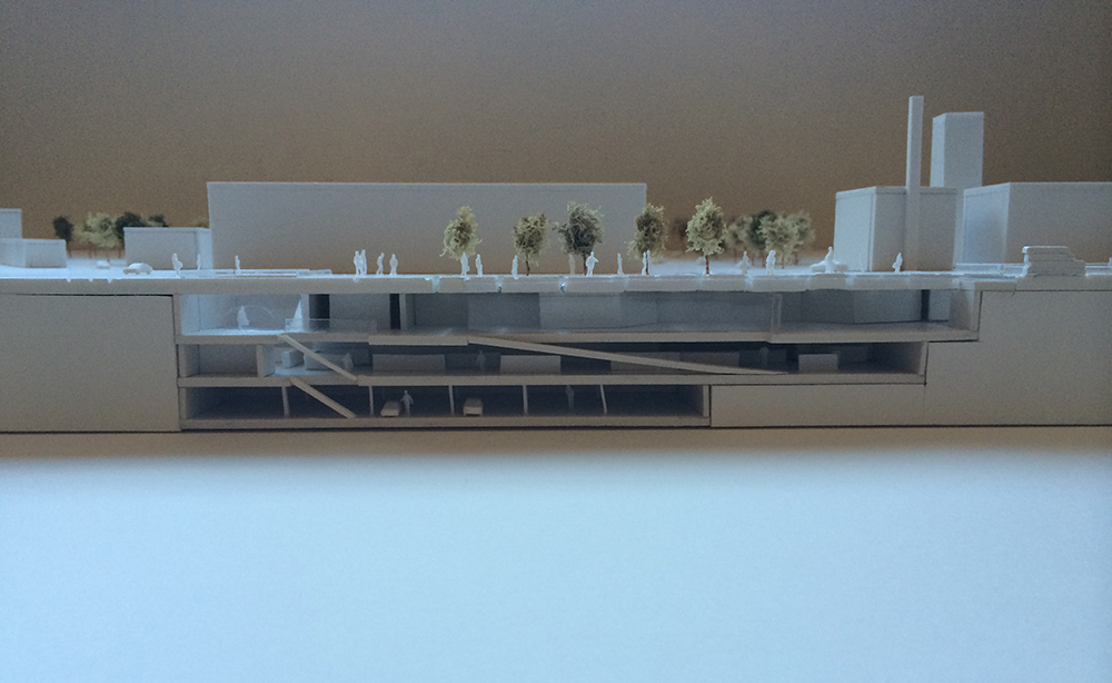
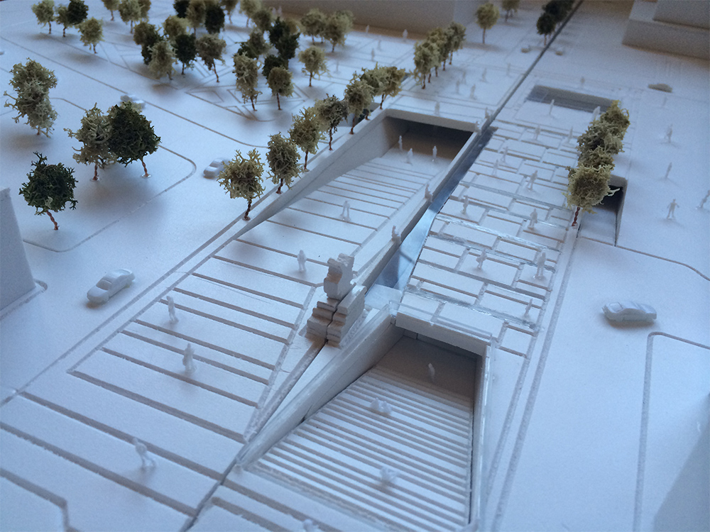
Il progetto vuole essere un percorso raccontato che dalla quota della città porta a quella del fiume per far vivere quasi naturalmente le sue sponde. Tramite dei percorsi verdi, pavimentati ed edificati si esplorano il paesaggio e le attività: museo del Tevere, bar – ristoro, internet-point /emeroteca, pista ciclabile, spazi per lo sport, la sosta ed il tempo libero. Riportando il fiume alla sua città.
Il concept è stato da subito quello di legare tra di loro i vari aspetti morfologici e funzionali del contesto urbano. In un contesto in piena evoluzione e cambiamento di edifici industriali che ritrovano una nuova vita e in una domanda e richiesta basata su università e studenti, è nata l’idea del centro per il tempo libero. Un luogo dove il contatto con la natura e il paesaggio futuristico creano un atmosfera di relax.
Il risultato finale è dato dal lavoro di forze e tensioni direzionali che concorrono alla trasformazione formale convertendo le tracce del sistema urbano in direttrici e divenendo un sistema di flussi funzionali che si intersecano tra di loro creando dei pieni e dei vuoti.


Alessia Guerrieri
Tesi di Laurea Prima Facoltà di Architettura Ludovico Quaroni, Università di Roma “La Sapienza”
Relatore: Prof. Marcello Pazzaglini
Correlatore: Prof. Loris Rossi, Arch. Marialuigia Micalella
Monte Mario Green Lab
site
The project area is located in Rome, inside an urban void near Basilica of St Peter, between the “Monte Mario hill” natural area and the consolidated city, built in the 60s. The site was characterized by the presence of brick kilns, from which building materials for the construction site of Basilica of Saint Peter came out.
Nowadays the above mentioned area embraces just one brick kiln left, which is almost in the middle of the site, a very important infrastructural node linking subway and railway and the reserve of “Monte Mario”, that at the moment has not a real connection with the surrounding area because of the lack of a real entrance to the natural area, although it’s an amazing panoramic viewpoint of the St. Peter’s dome.
concept
The project aim is the enhancement of features of the area: the natural element, coming from the natural hill, and the technical one, coming from the history of the old kilns.
So, the concept is the result of the overlapping of two paths:
1. the green path, that comes down from the hill pushing against the city, until it finds the border of the district, which coincides with the limit of the area.
2. the path of knowledge, that starts from the valley around the brick kiln, historical place of technique, and goes on the hill, digging its side with a path that tells the history of the place, until it arrives on the top of the hill to see St. Peter’s Dome.
main theme
The central thread that keeps together these two paths, is the RESEARCH.
The project consists in a big public space of research: a research center with green labs, a library and an auditorium, located on the border of the area plus the entry pavilions of the park, located upon the hill.
In the middle, a big square around the focus point of the brick kiln, in which the natural feature of the area becomes a serial of green stripes from which children can learn something about botanic and the kiln becomes the start point for the path of knowledge, up to the hill.


Gaia Rauco
Tesi di Laurea Prima Facoltà di Architettura Ludovico Quaroni, Università di Roma “La Sapienza”
Relatore: Prof. Marcello Pazzaglini
Correlatore: Prof. Loris Rossi
Parco lineare lungo le Mura Aureliane, Roma.
Roma è l’unica capitale europea a conservare, sostanzialmente integro, il circuito delle mura antiche: sistema difensivo, margine, confine tra costruito e territorio, le mura hanno da sempre riassunto il carattere, la tradizione culturale, la storia della città.
La cinta muraria costituisce uno degli ambiti di programmazione strategica proposti dal nuovo Prg. Si tratta di una proposta di grande rilievo, poiché per la prima volta alle Mura di Roma non solo viene riconosciuto lo statuto di manufatto eminente, da sottoporre a specifiche misure di manutenzione e restauro, ma anche di struttura urbana primaria ed in particolare di elemento capace di svolgere un ruolo rilevante nel consolidamento e nella valorizzazione della forma urbana.
Cinque sono state le questioni principali che nello studio progettuale, promosso nel quadro del nuovo Prg, prima, e delle attività dell’Ufficio per la città storica, poi, si sono dovute affrontare:
1. il riconoscimento della cinta muraria come grande segno della struttura del territorio e quindi del suo ruolo nella riqualificazione della città storica;
2. l’esigenza di un riconoscimento sostanzialmente nuovo di questo manufatto diventato residuale, mal usato dalla Roma moderna che ne ha scavalcato i confini facendone spesso il luogo di depositi, di aree degradate ed intercluse;
3. la risignificazione di un manufatto fortemente irregolare, stranamente conservato, che separa il centro storico vero e proprio dalla metropoli esterna e che deve anche essere riconfigurato nelle sue appartenenze ai diversi paesaggi del territorio storico romano (il paesaggio dell’archeologia, il paesaggio delle infrastrutture, il paesaggio delle ville);
4. l’identificazione delle matrici formative interne delle diverse parti urbane e dei diversi segmenti componenti e delle relative modalità strategiche;
5. le modalità complesse e processuali in cui il progetto urbano, da un lato, e quello di architettura dall’altro possono concorrere alla piena valorizzazione dell’ambito nel suo complesso e, quindi, le questioni propriamente propriamente inerenti ai livelli di progettazione più pertinenti.
Il tratto pressocchè rettilineo della cinta muraria, situato tra l’Anfiteatro Castrense e Porta Metronia, è dominato urbanisticamente da un lato dal grande invaso delle due piazze di San Giovanni e del Laterano e dall’altro dal vasto incrocio di via Carlo Felice con via Appia Nuova, attraverante la nuova Porta S. Giovanni accanto alla più antica Porta Asinaria.
Visualmente sono rilevanti la Basilica di Santa Croce in Gelusalemme ed il suo complesso conventuale come pure la facciata di San Giovanni ed il sistema dei Palazzi Laterani, che mettono in rapporto questo tratto delle mura direttamente con due dei nodi del sistema sistino.
Per il resto questo tratto richiede una gestione separata dei due segmenti che lo compongono.Nel primo, da Santa Croce a San Giovanni, l’esigenza degli spazi pubblici all’interno, propone il problema della riforma di quelli esterni interessati particolarmente dal mercato di via Sannio, dalla nuova stazione della metropolitana presso San Giovanni e dall’arrivo dell’attuale tangenziale sopraelevata.
Nel secondo tratto, da via Sannio fino a Porta Metronia, non percorribile all’interno, sono invece da effettuare interventi di riconfigurazione all’esterno, garantendo il percorso del Parco lineare integrato, mediante riforme e ridimensionamenti delle funzioni a prevalente carattere sportivo che attualmente occupano l’invaso della cinta muraria.
Gli obiettivi del progetto sono:
1. la fruizione delle Mura in maniera non convenzionale attraverso percorsi, passerelle e punti di osservazione significativi e non usuali;
2. la creazione di zone espositive e didattiche per una migliore comprensione dell’emergenza archeologica;
3. la creazione di una fascia verde attrezzata che ricuce la varie aree verdi presenti nella zona e rappresenta una porzione del parco delle Mura Aureliane;
4. la ridefinizione e il ridisegno delle attività ormai storicamente presenti nell’area ovvero il mercato di via Sannio, la Società Sportiva Romulea e il circolo sportivo Asd Tennis Roma.


Marta Di Vincenzo
Tesi di Laurea Prima Facoltà di Architettura Ludovico Quaroni, Università di Roma “La Sapienza”
Relatore: Prof. Marcello Pazzaglini
Correlatore: Prof. Loris Rossi
Museo Nazionale dell’Ebraismo Italiano e della Shoah


Alice Monsef
Tesi di Laurea Prima Facoltà di Architettura Ludovico Quaroni, Università di Roma “La Sapienza”
Relatore: Prof. Marcello Pazzaglini
Correlatore: Prof. Loris Rossi


Yume Tanaka
Tesi di Laurea Prima Facoltà di Architettura Ludovico Quaroni, Università di Roma “La Sapienza”
Relatore: Prof. Marcello Pazzaglini
Correlatore: Prof. Loris Rossi
5-star hotel on the Bay of Tokyo
The building is sited in Harumi Island, in Tokyo. Its shape derives from an analysis on the view of the Tokyo Bay waterfront, and a formal revisit of 「月」, the character of “moon”, that has old connections in Japanese literature with the idea of relax and nature contemplation.
The shape of the plan opens to the bay and the view, with a direct contact with the sea. We find the same relation with nature in the facades, that break up and connect to the sky through trees and gardens.
The project is divided into 2 buildings, connected by footbridges: the one more related with the sea, since it is hanged in space, contains the spa and the restaurant, while inside the one on the ground there is the ryokan (traditional Japanese style inn). Preceded by a sociological study on luxury, the hotel is formed by suites, from smaller ones to duplex and triplex ones.
The tradition of ryokan and onsen (thermal baths) is preserved in the interiors, with the usage of Japanese materials and objects.


Davide Marvardi
Tesi di Laurea Prima Facoltà di Architettura Ludovico Quaroni, Università di Roma “La Sapienza”
Relatore: Prof. Marcello Pazzaglini
Correlatore: Prof. Loris Rossi
Nuovo parco urbano del Mandrione_Polo culturale sugli orti urbani ecocompatibili
Luogo: Roma
Il progetto ha come tematica quella della riqualificazione urbana dell’area dell’acquedotto romano situato in via del Mandrione. Il lotto è attualmente occupato da un vallo ferroviario dismesso, da diversi capannoni industriali e da orti urbani. La proposta progettuale, in ottemperanza delle previsioni del NPRG, è di insediare un parco urbano che valorizzi l’acquedotto romano e che possa essere un polo ricreativo e culturale per i quartieri circostanti. La strategia progettuale è stata quella di scegliere la funzione degli orti urbani da inserire come elemento caratterizzante e socialmente aggregante all’interno del parco. Tale funzione è stata prediletta in quanto già presente nell’area. Dal punto di vista progettuale si è scelto di comporre per “linee“, perciò il parco si basa sull’addizione delle tre linee: linea dell’acquedotto, linea del paesaggio, linea degli orti. Questi tre percorsi definiscono l’intervento.
All’interno del sito sono stati ipotizzati dei fabbricati contenenti funzioni a servizio del parco stesso. Uno di questi edifici, il polo culturale sugli orti urbani, è stato poi approfondito e progettato sino alla scala architettonica dell’1:200.

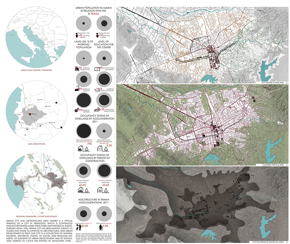
Arlinda Dulaj
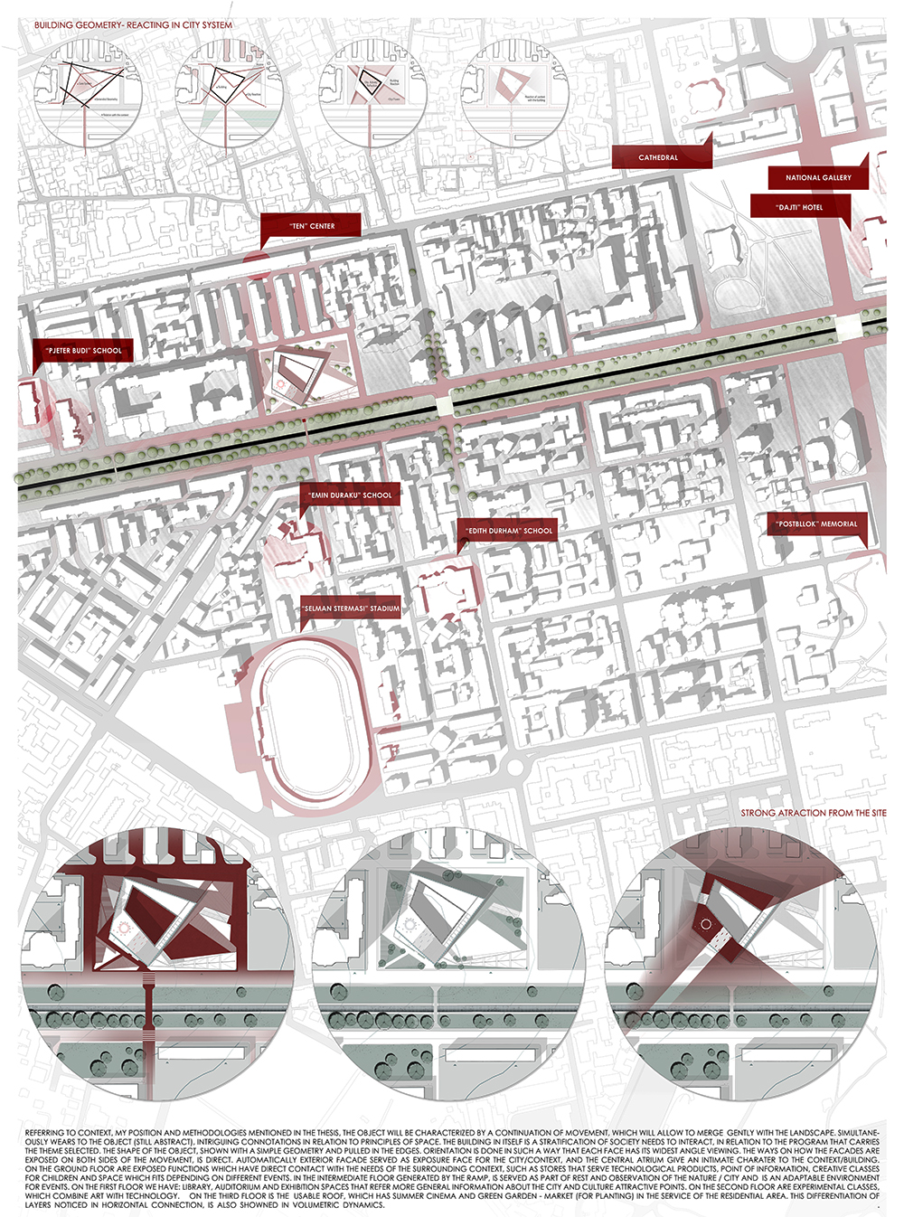
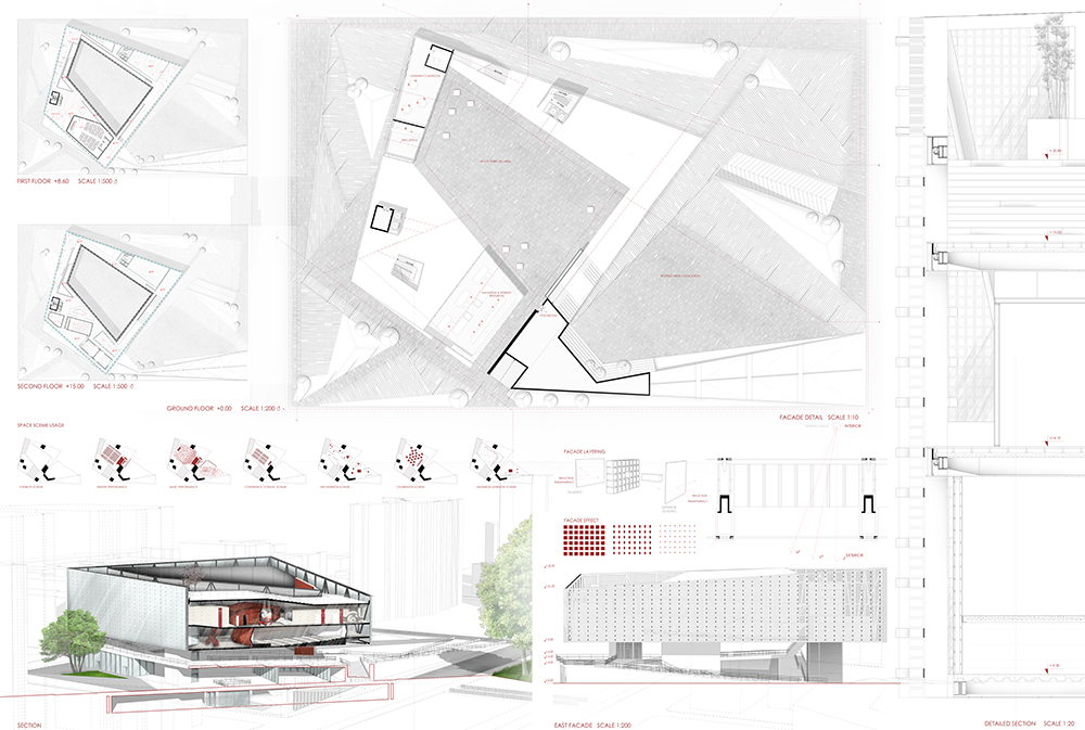
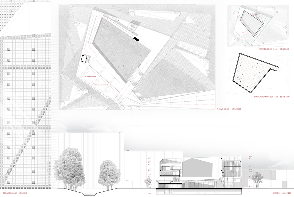
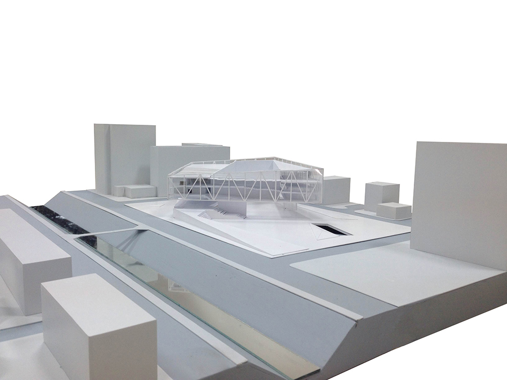
Multimedia and Animation Center in Tirana.
POLIS University Architecture and Urban Design Faculty Tirana
Besart Gjana
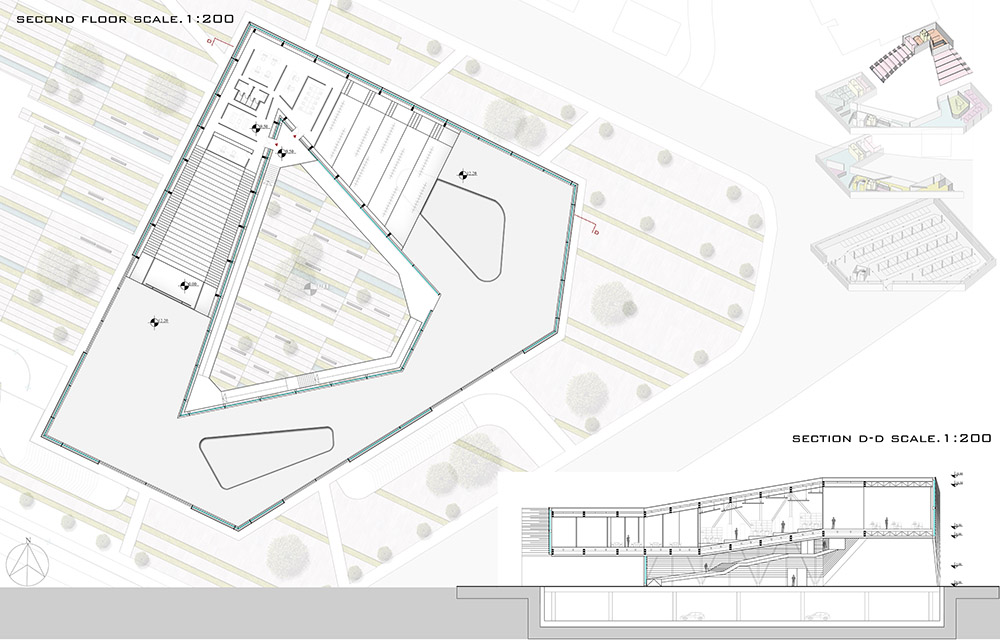
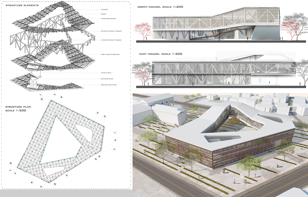
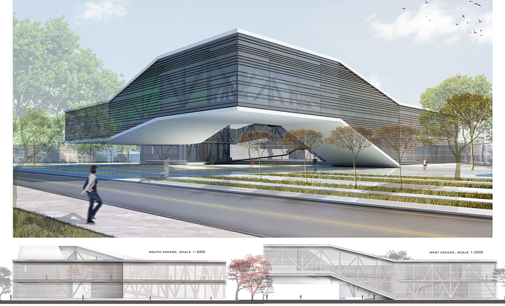
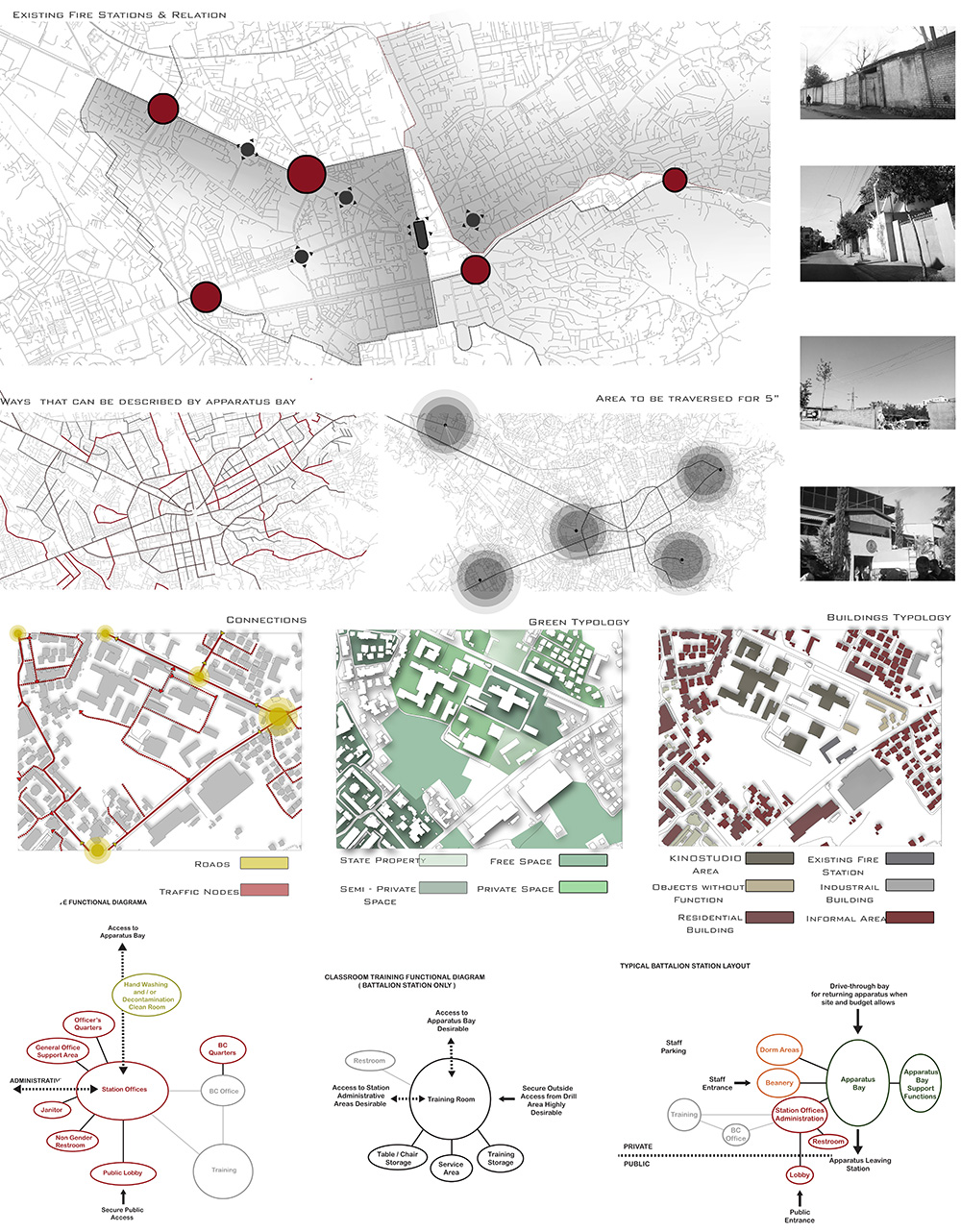
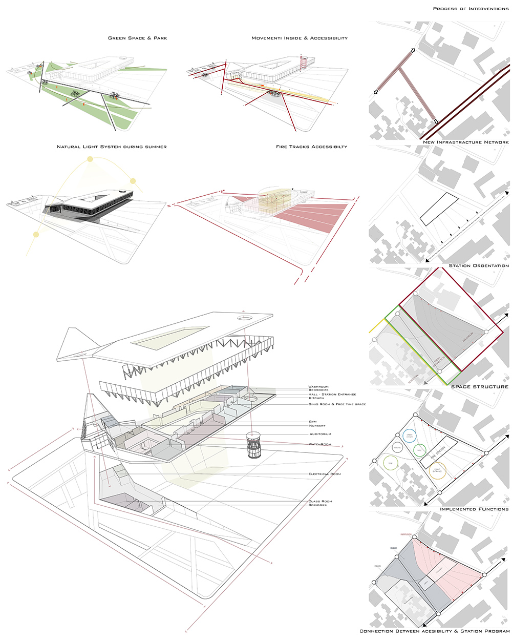
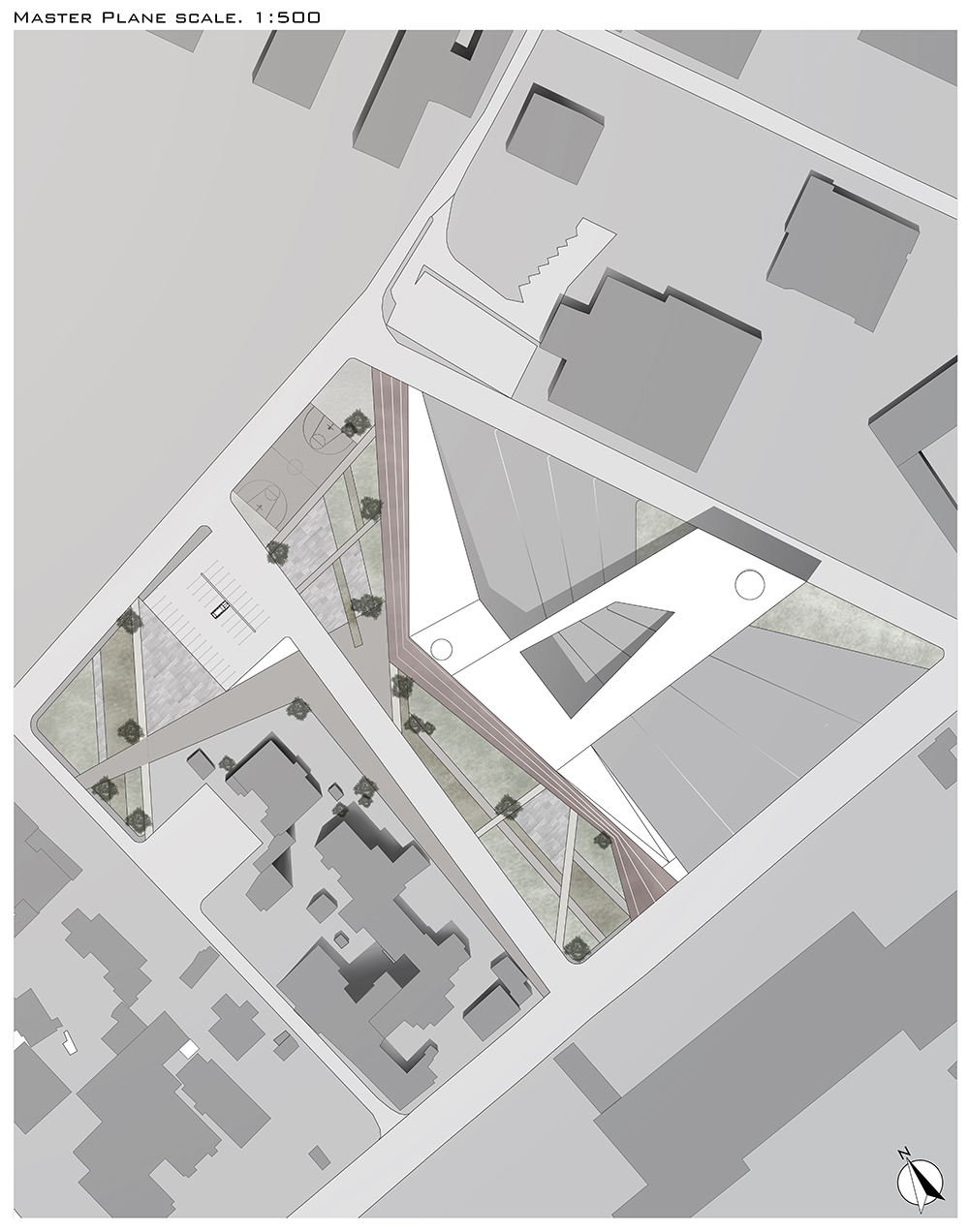
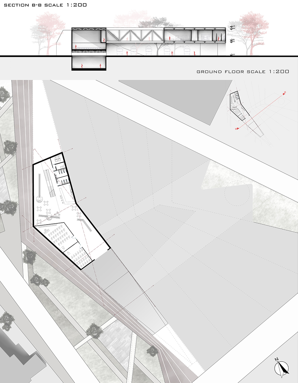
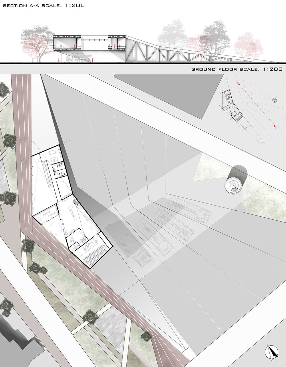
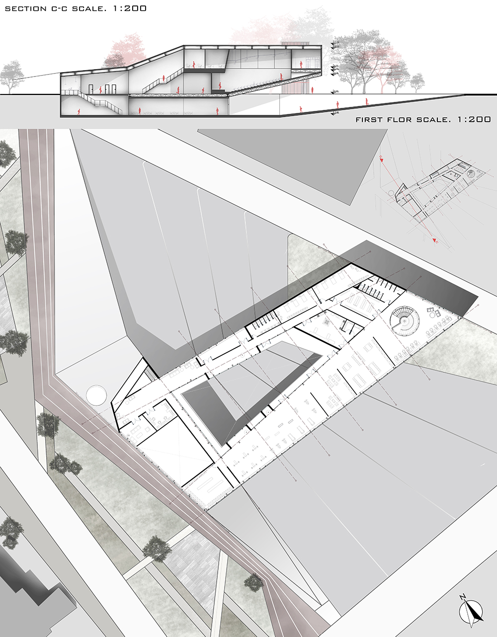
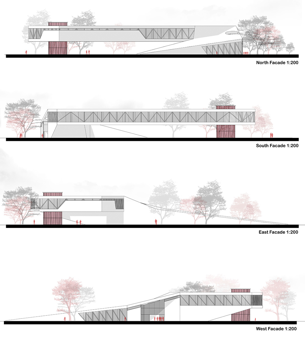
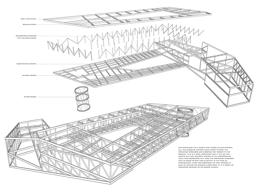
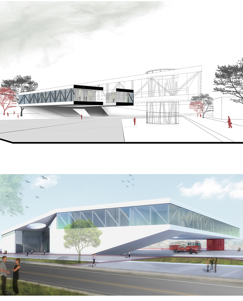
Fire Station in Tirana and center for public safety.
POLIS University Architecture Faculty – Tirana (AL)
Arsida Ajazi
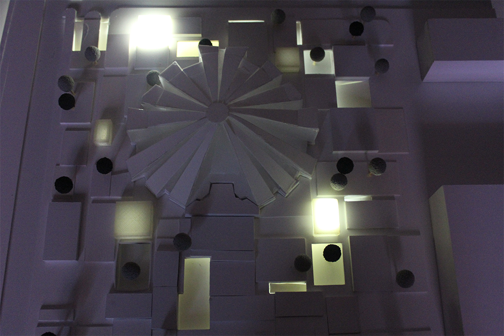
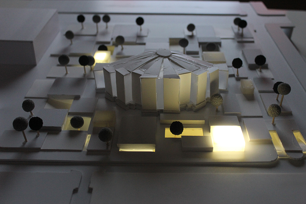
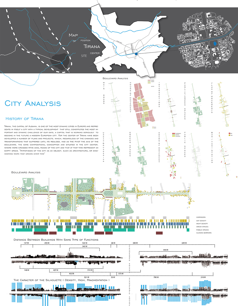
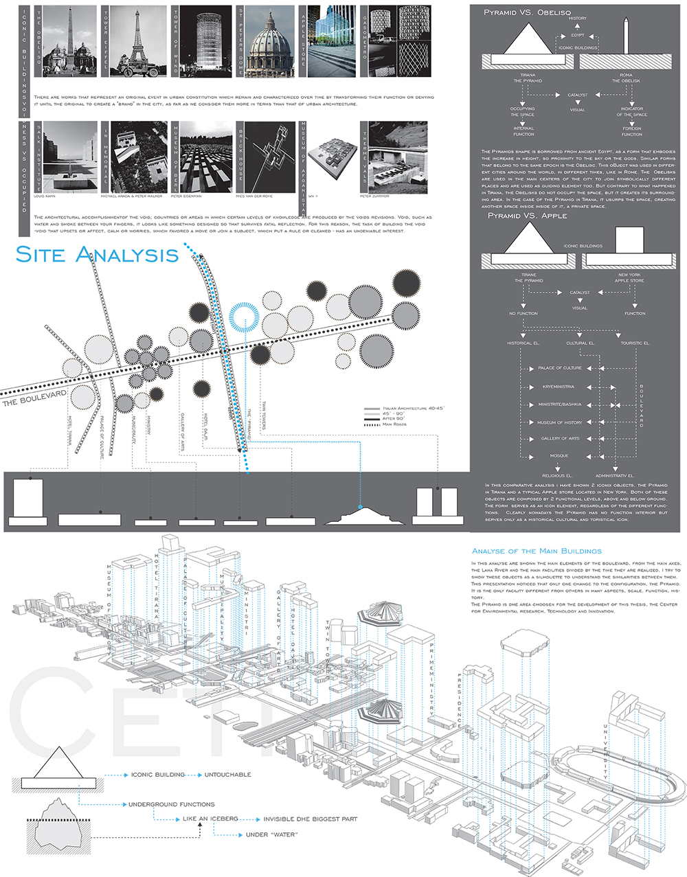
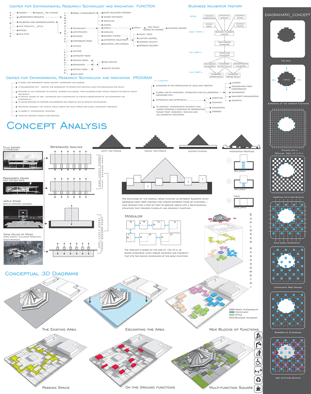
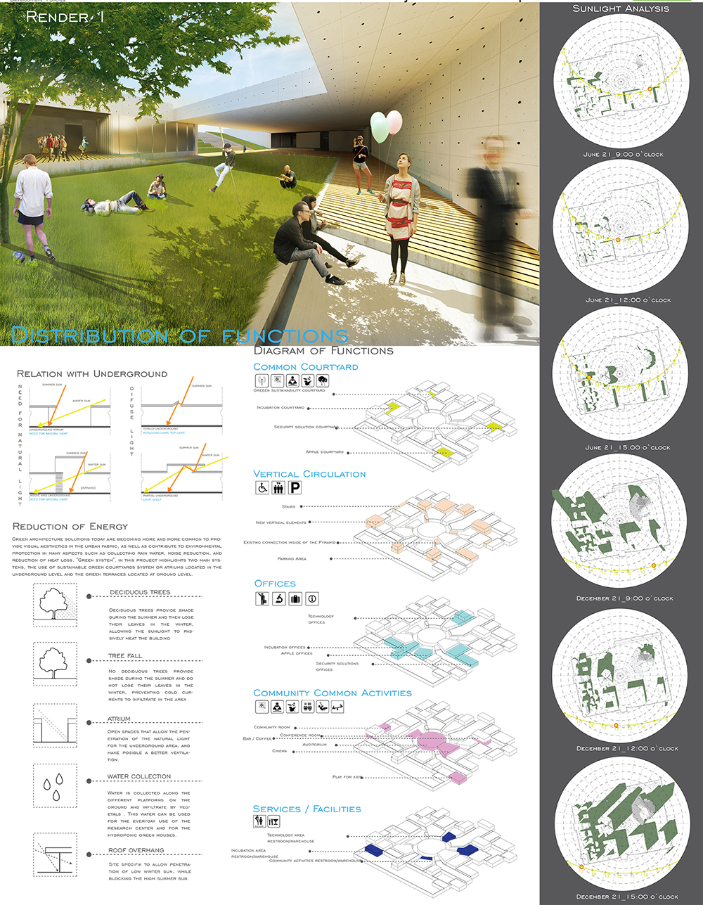
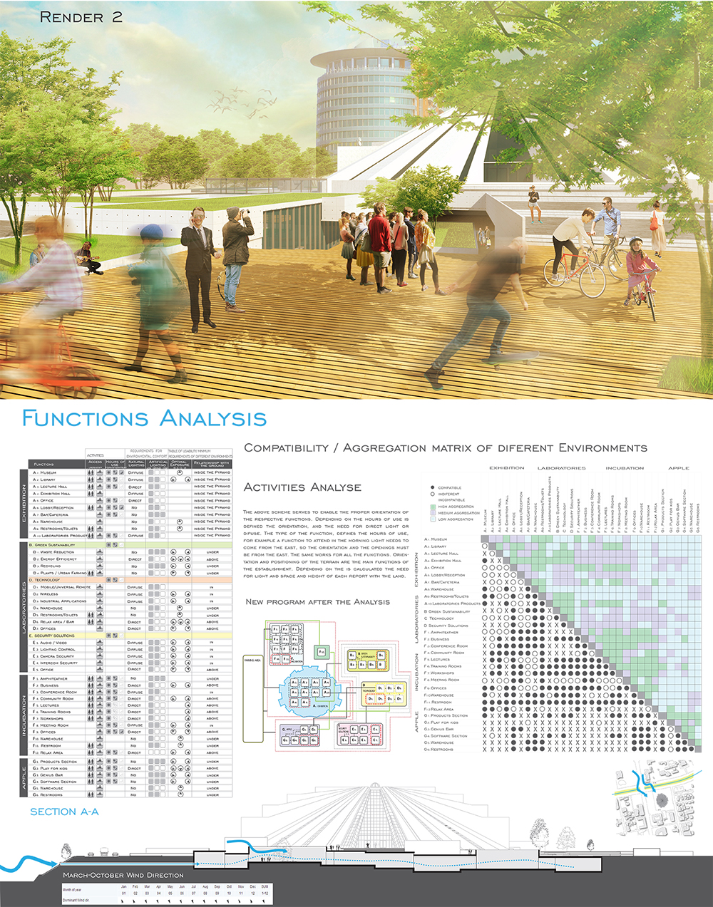
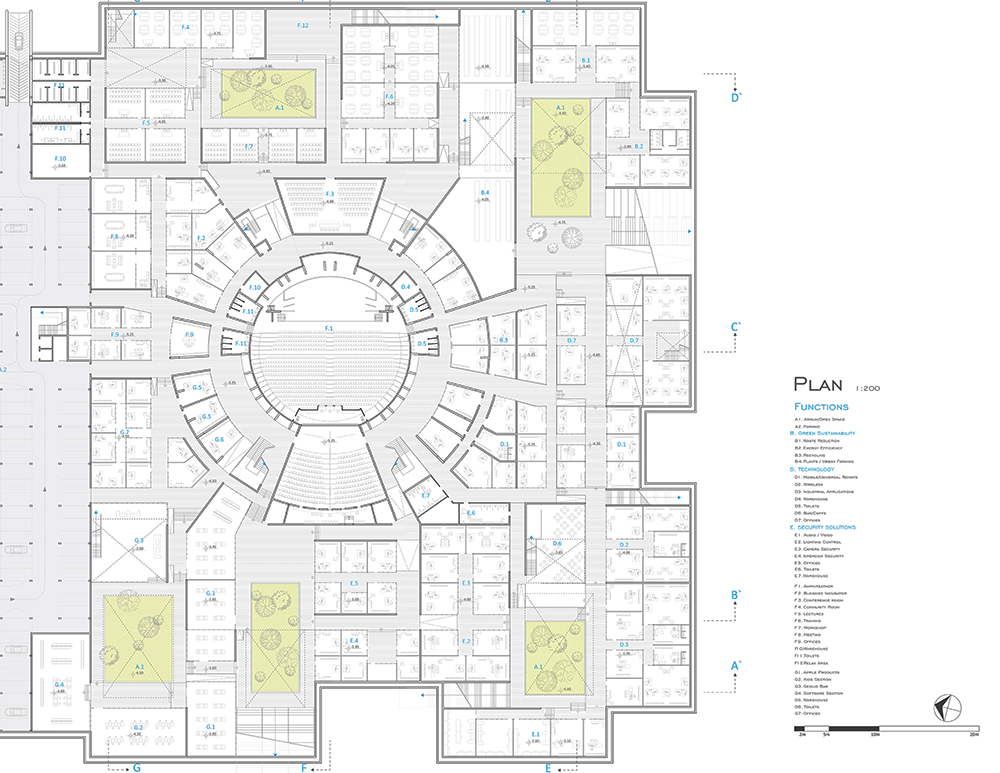
Center for Environmental Research, Technology and Innovation in Tirana
(The study site was in existing Hoxha Pyramid)
POLIS University Architecture and Urban Design Faculty – Tirana (AL)
Donika ÇETTA-JUNÇAJ
Professional Master in Urban and Landscape Design
POLIS University Architecture and Urban Design Faculty – Tirana.
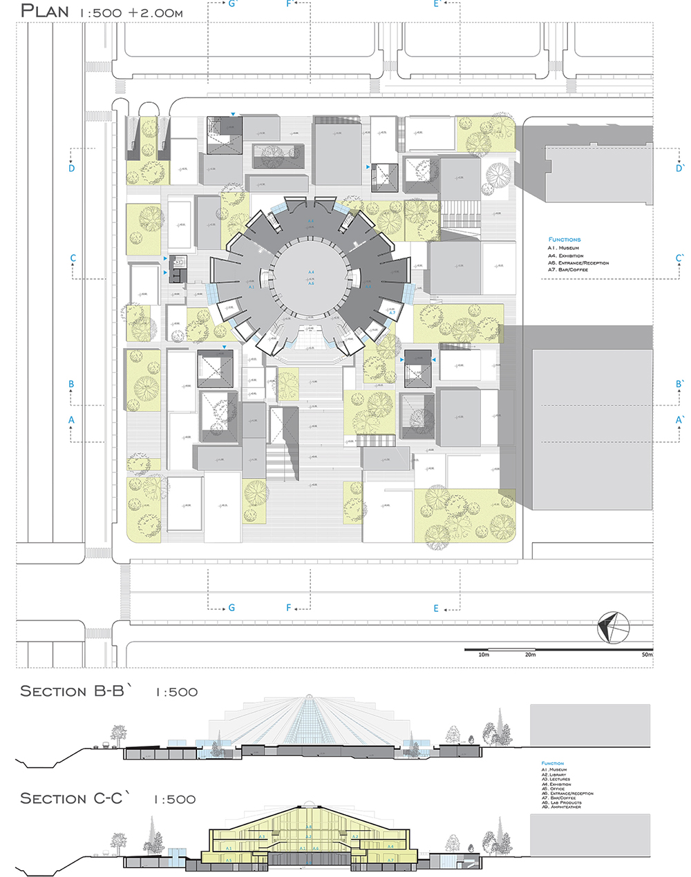
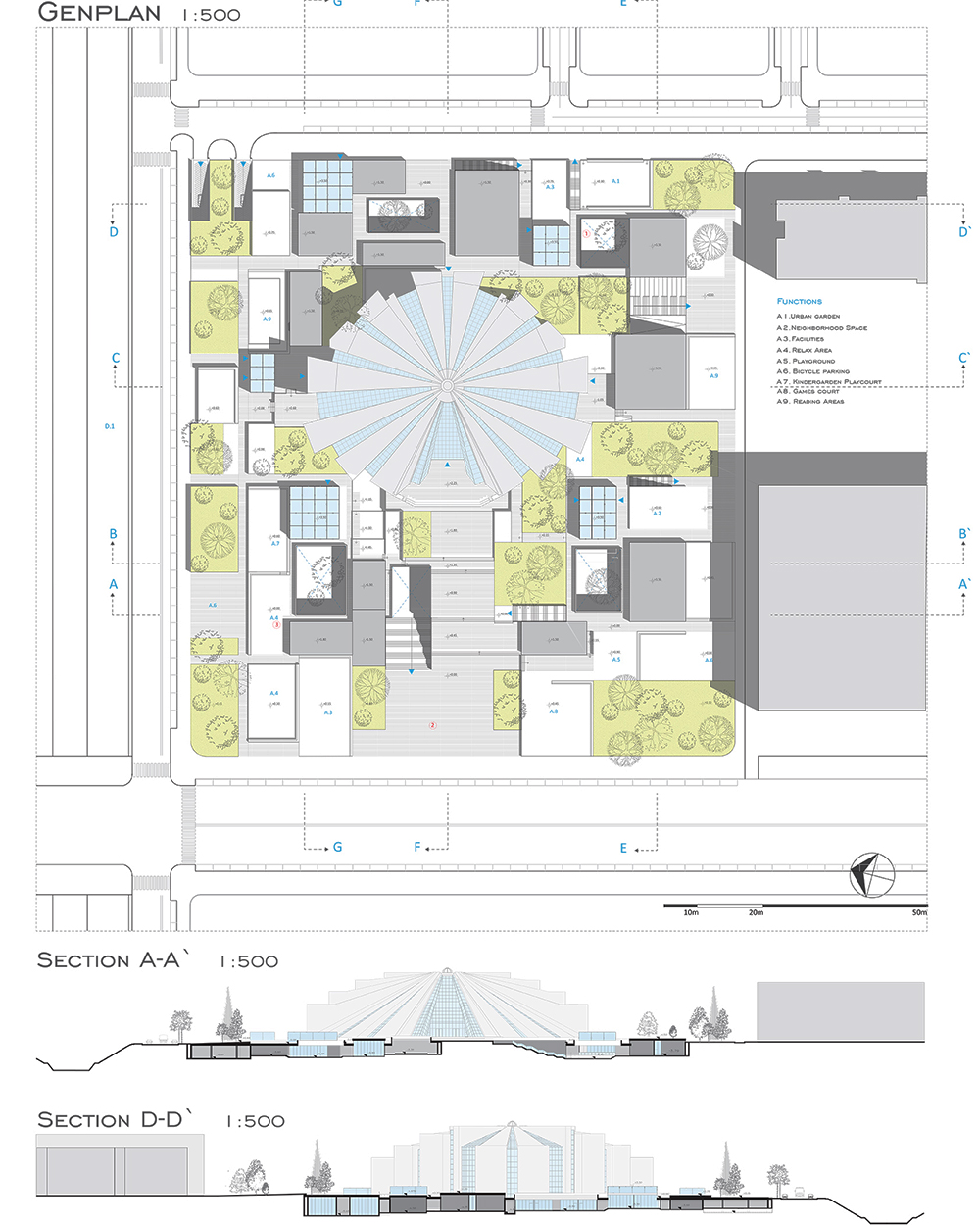
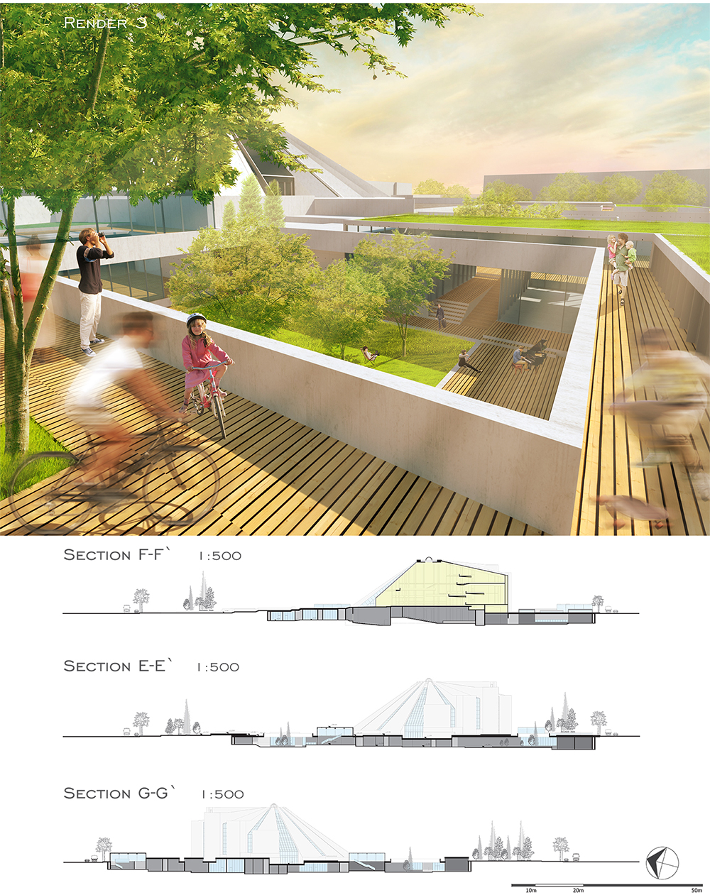
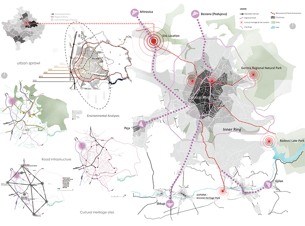
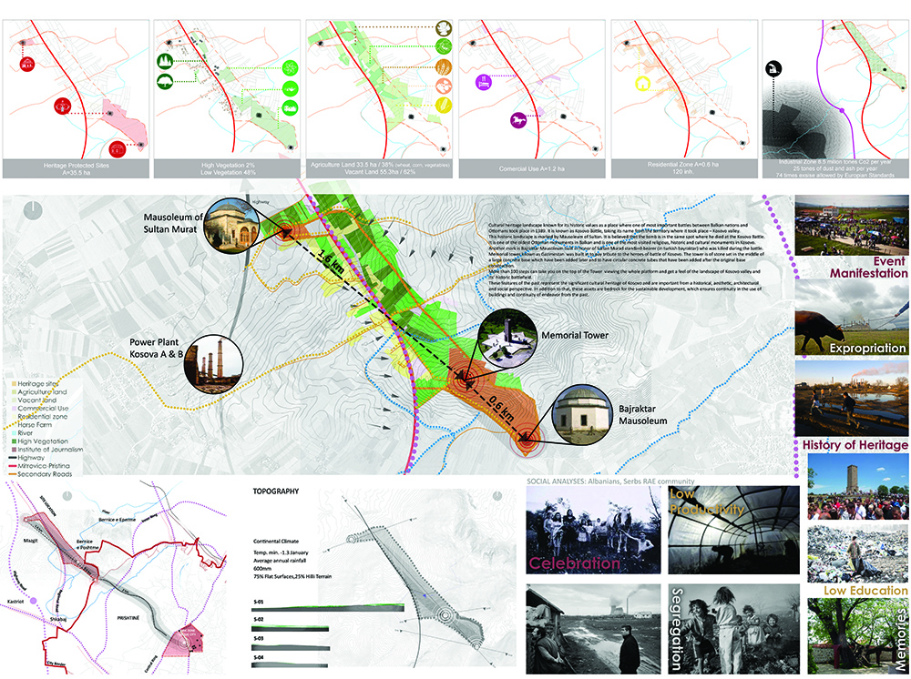
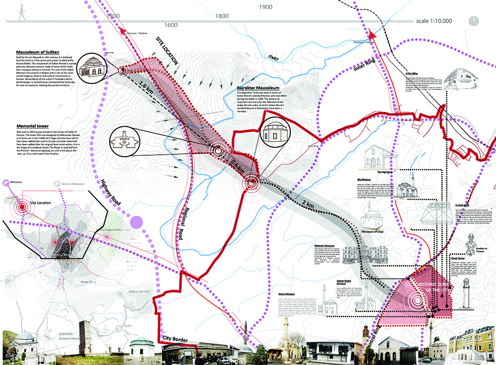
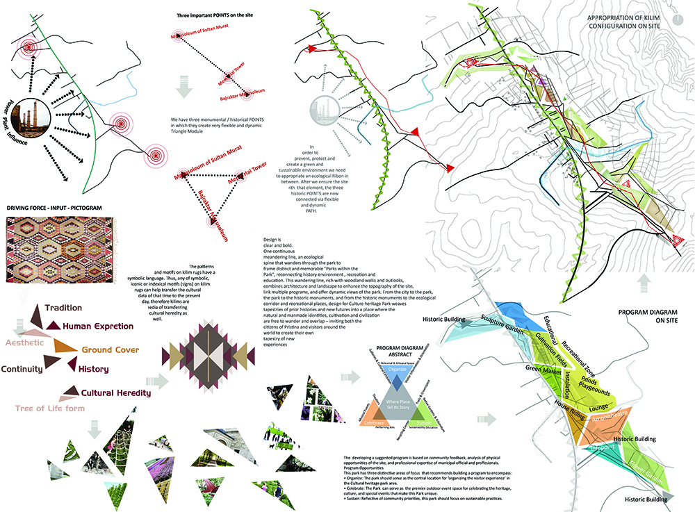
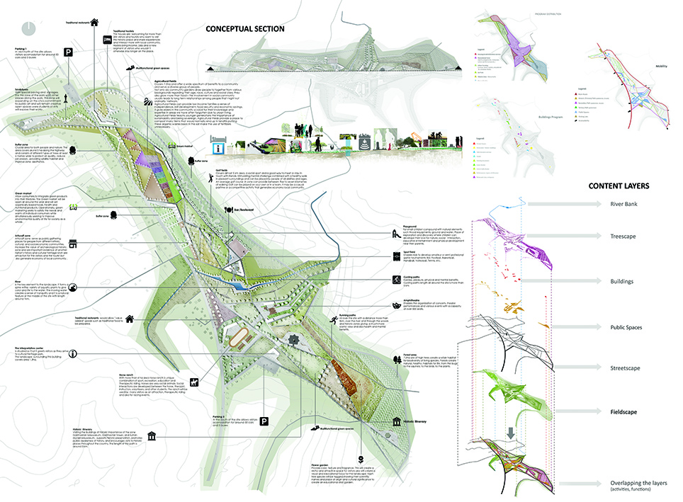
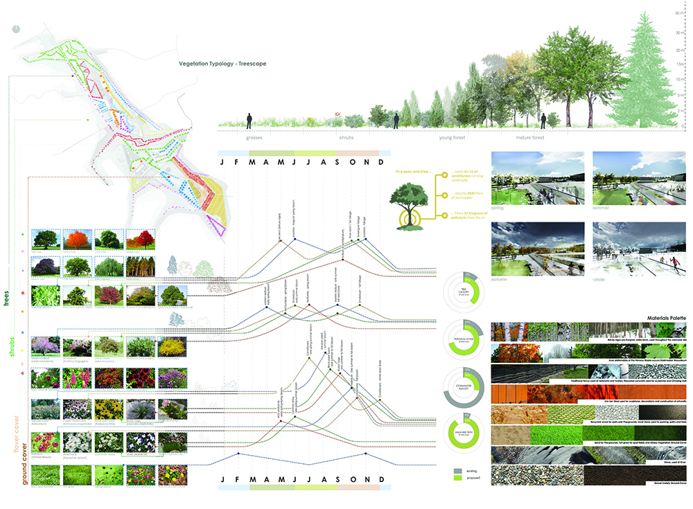
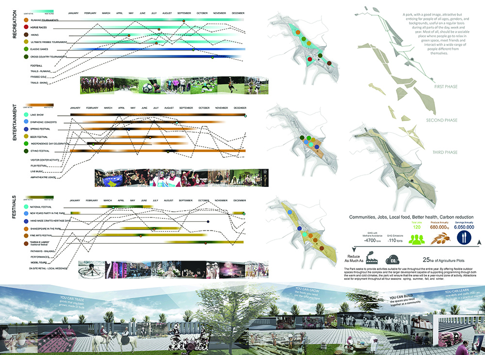
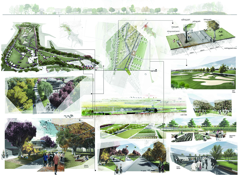
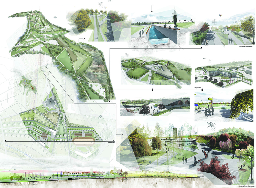
Thesis Title: MULTIPLE WAYS OF SEEING ONE PLACE “Cultural Heritage Park” – District of Pristina in Kosovo
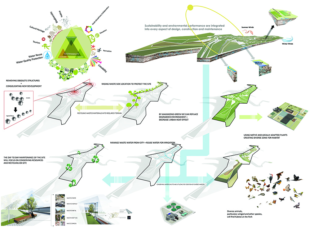
The design proposal for the cultural heritage park in the famous Kosovo battlefield is developed by identifying different layers from which the site is composed. These layers of physical, historical, social, economical and environmental content are defined and interpreted individually. Furthermore their interrelationship and respective impact, as well as their overall importance on the general scheme of the envisioned cultural heritage park is discussed. Finally visual and technical drafting of the design proposal is layed out as a joint compromise of all the factors influencing the site in respect to thesis aims and objectives for the development of the proposed cultural heritage site: preserving the historical values; revitalizing and reusing in an adaptive way the individual monuments and the historical site as a whole; improving living and working conditions for inhabitants; promoting tourism and recreation; protecting environment and promoting sustainable planning and architecture.
What precisely are the heritage values of the place? Field of Blackbirds is one of the most significant cultural landscapes in Kosovo. As mentioned, the ensuing half century has also added a layers that says much about modern Kosovo and in particular the role of the state in economic, social and cultural development. I will focus on the heritage and naturals values deriving from the past and show how there are under threat from the subsequent processes of change in the site. The battle and the ground on which it occurred have transnational regional significance as major turning point. Moreover World Heritage listing would give international recognition to the place and lead to economic benefits to the region as a whole through cultural tourism. Such benefits might be jeopardized, however, by the modernization and urbanization policies that can rapidly change the character of site and threatening its heritage values.
Klaudjo Ruci
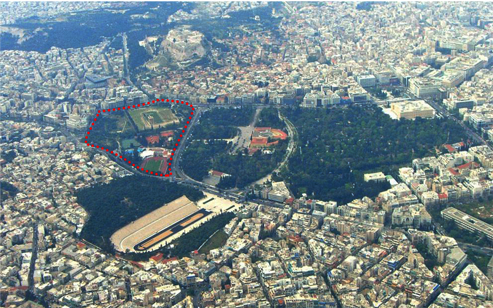
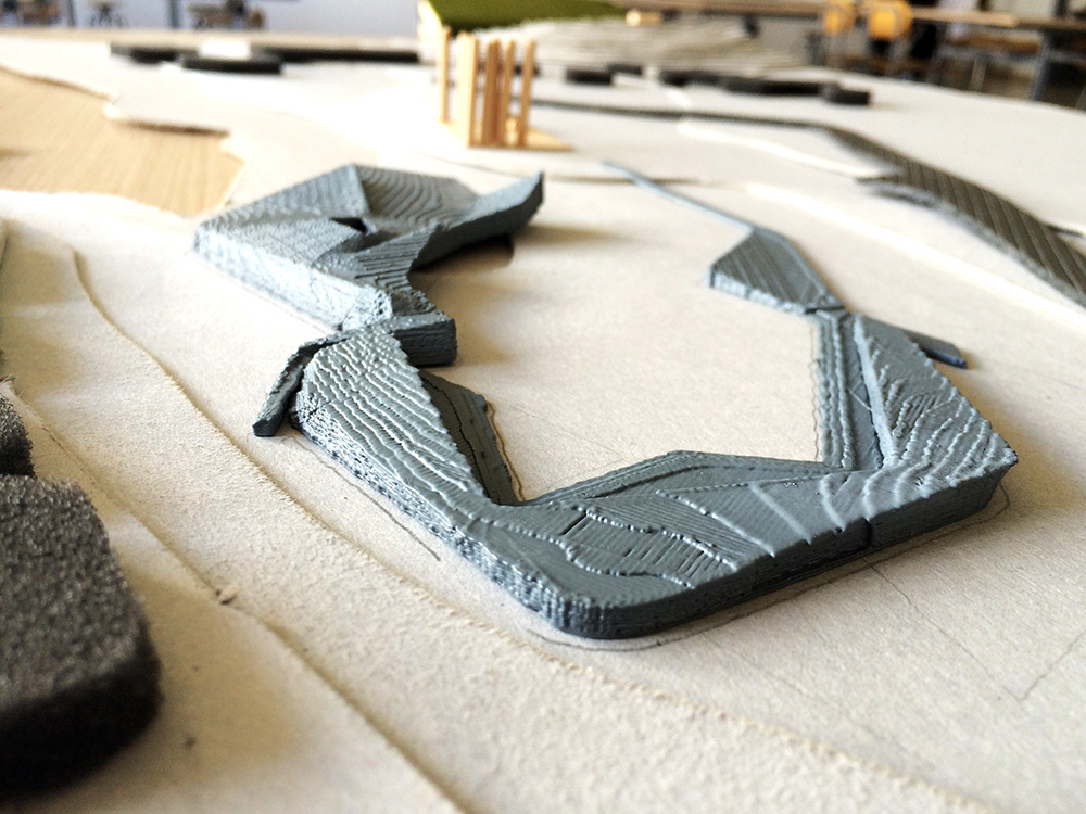
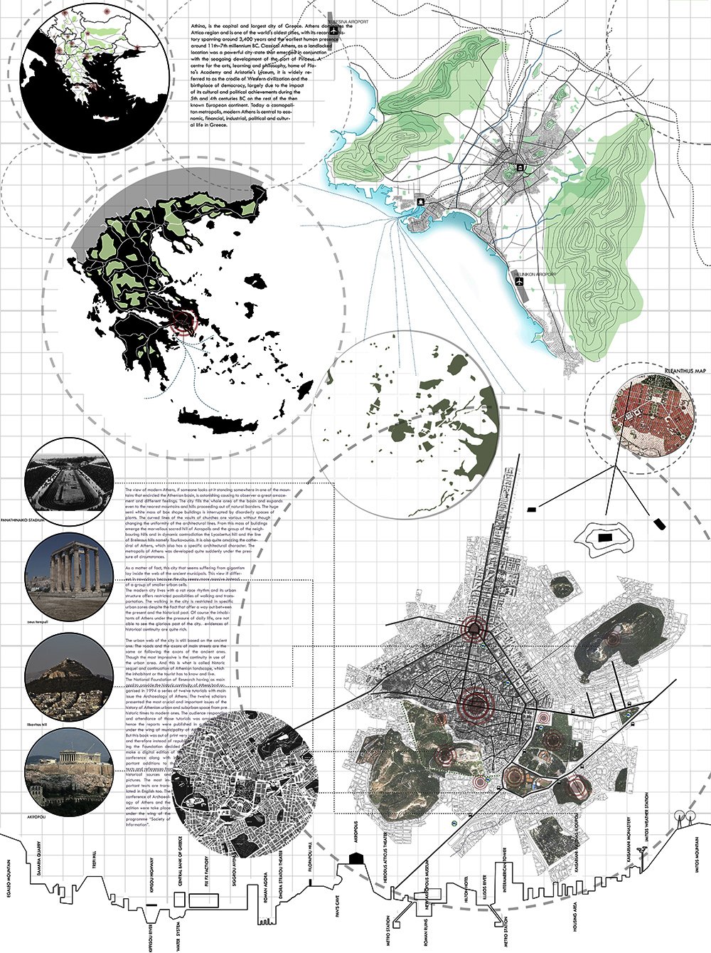
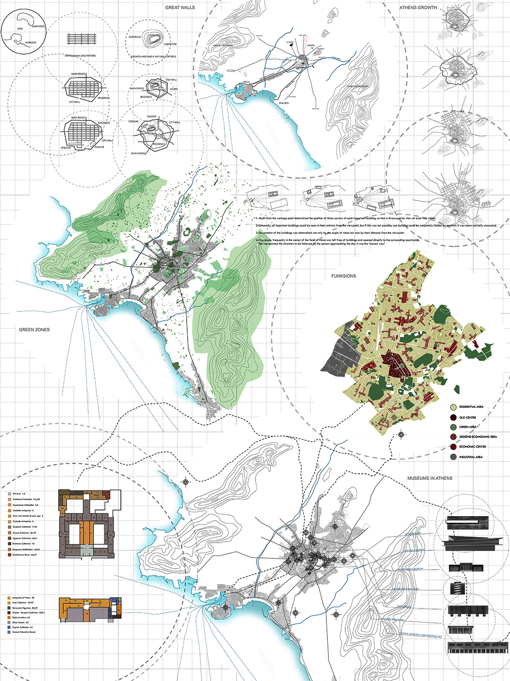
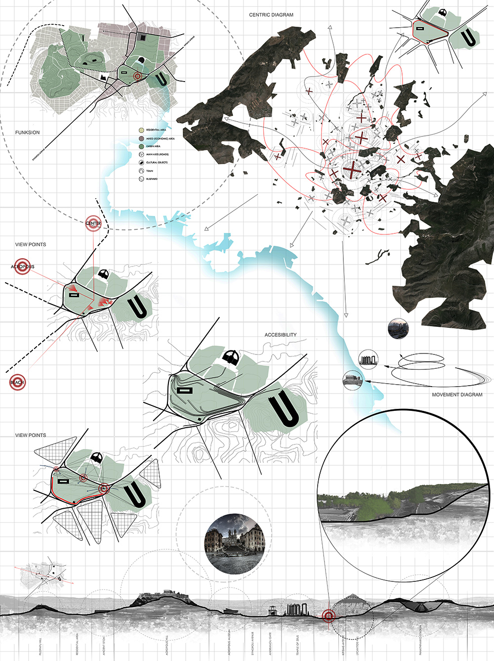
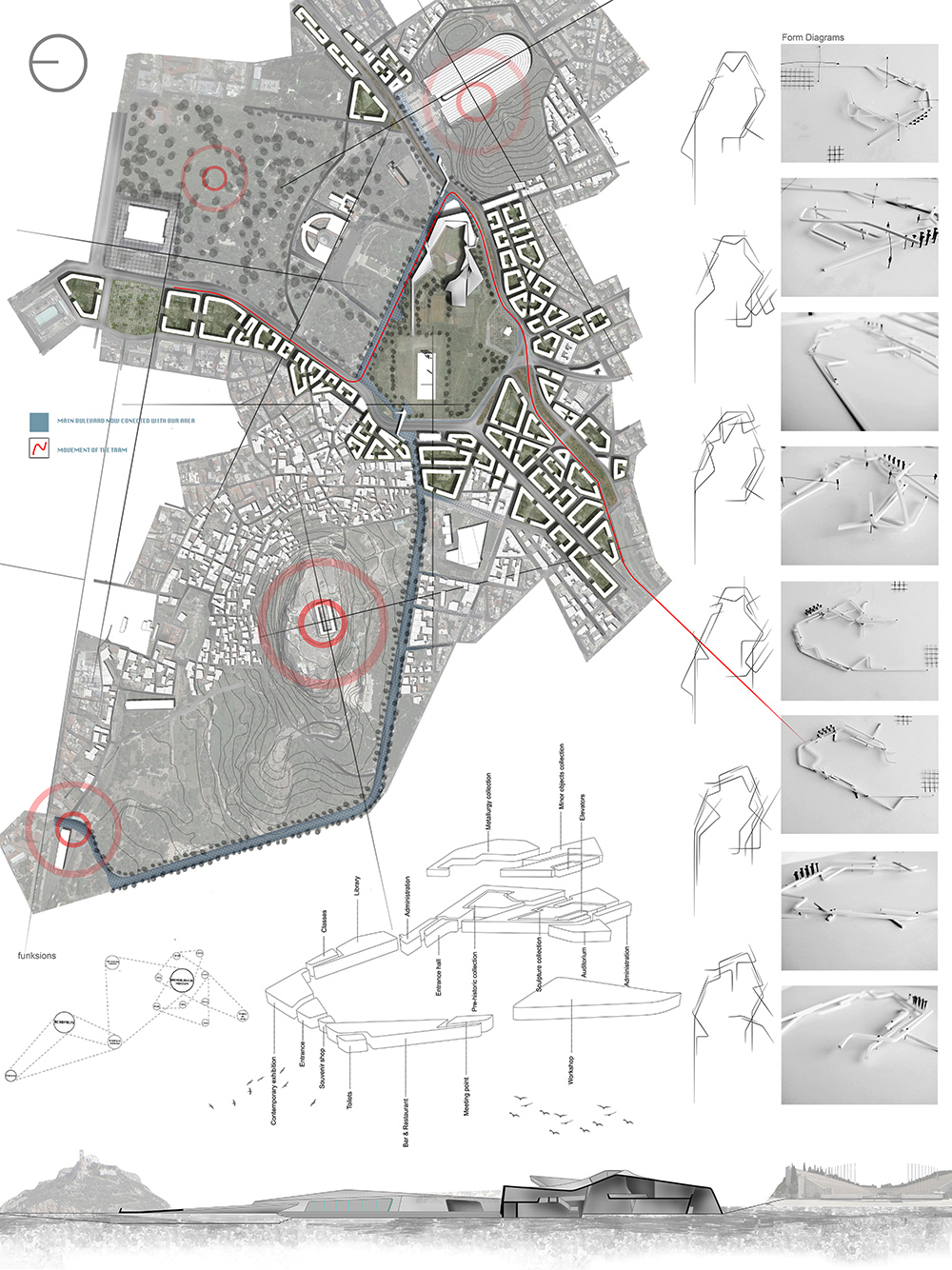
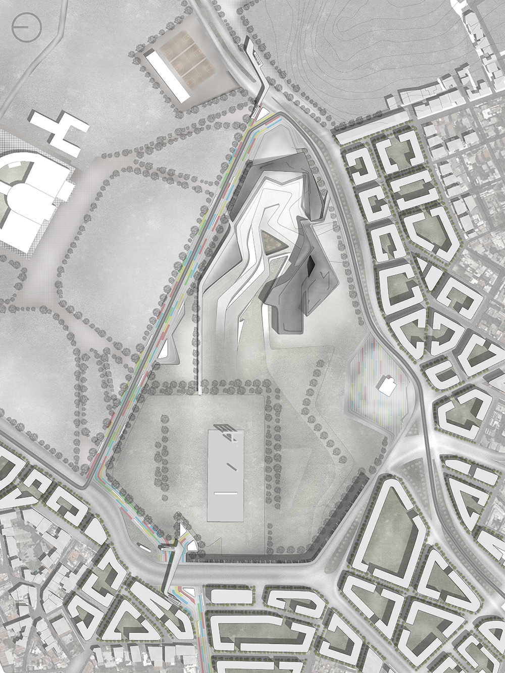
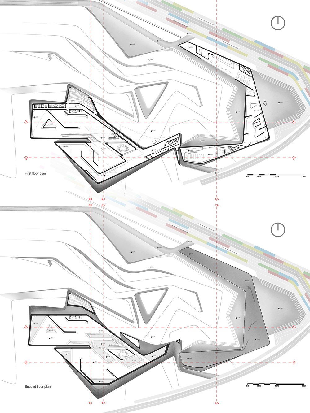
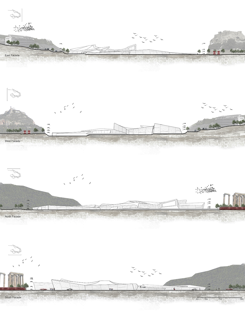
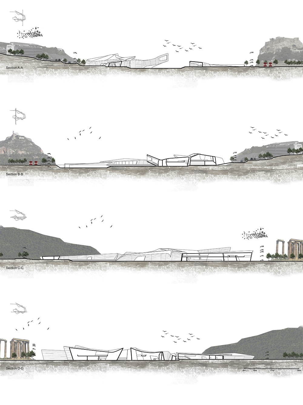
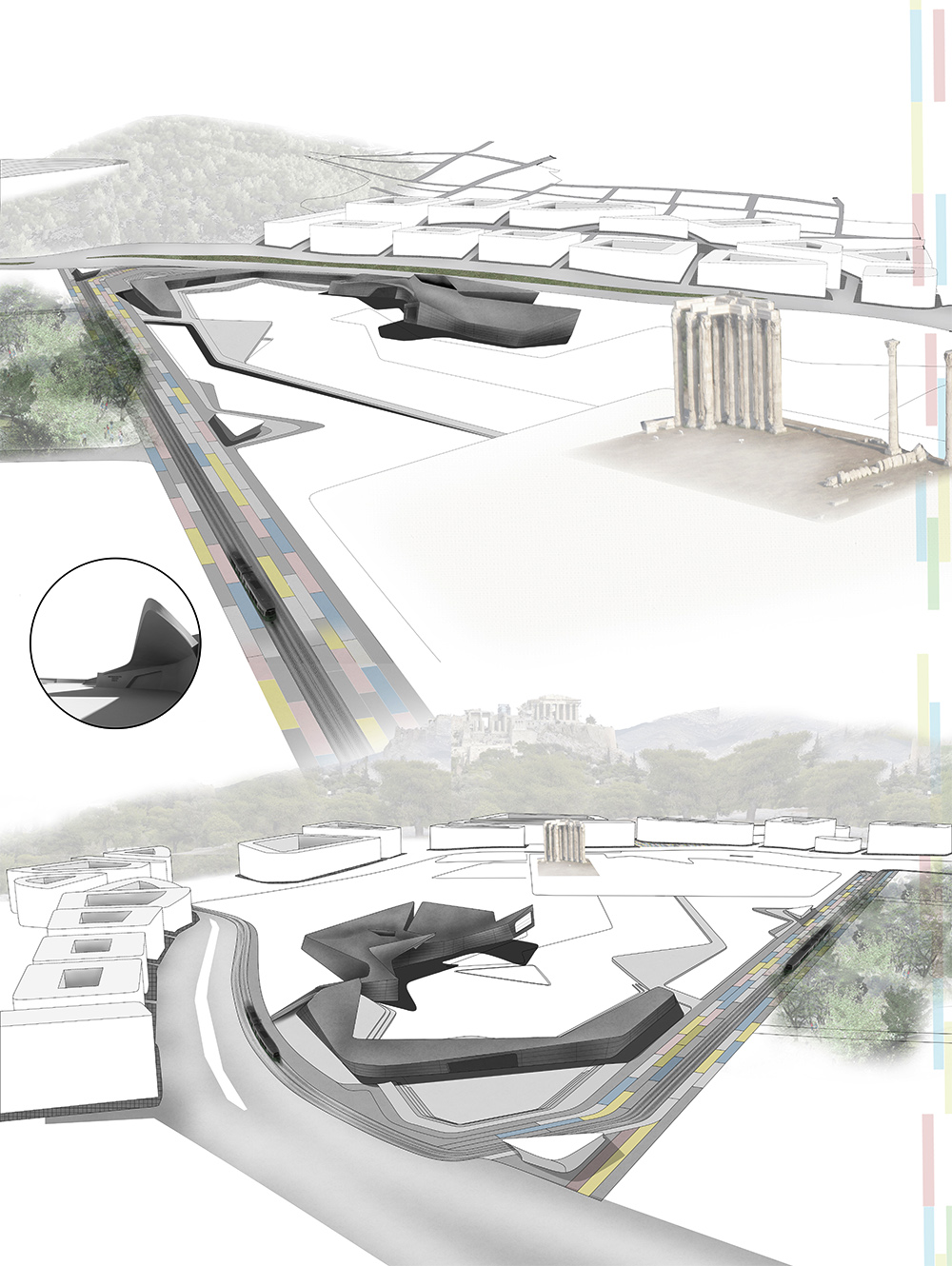
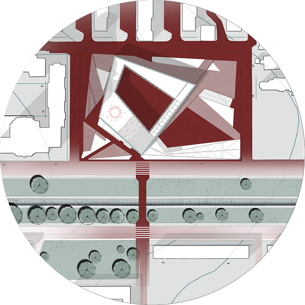
Archaeological and Historical Museum in Athens.
Synergetic Fluxes
POLIS University Architecture Faculty – Tirana (AL)
Museums deal with complex architectural questions. How can architecture provide enough exhibition space for various collections, how can collections be preserved and studied when the different fluxes flow inside the space, demanding their part? How can architecture orientate these flows to make sure the user achieves an enjoyable experience? Can design questions and principle overshadow the collections, or is it possible for a dynamic architecture to be the clear canvas for showcasing different collections? Museums in Athens, are main attractors of tourist, as well as economical benefactors to Greece, given the city’s history and enormous amounts of ancient ruins. These facts have led to the need for a new museum inside the center of the city, to shelter all the discoveries stocked inside storehouses, because of the lack of exhibition space. Synergetic Fluxes, is an archaeological museum, situated near the temple of Olympic Zeus, and as such serves a shelter for the ruins that are being discovered day after day, to preserve and study them. Furthermore, in its role as a fluxes collector, the museum offers spaces for public debate, the sharing of experience and knowledge and many practical and pragmatic activities related to a museum. The activities vary from educational to recreational ones, with the intertwining of these elements to achieve a more complete experience for the user. Educational activities are made from workshops and classes about excavations, art history, to teach and train young professionals and amateurs. The recreational activities are
public favorites, with bar and restaurant, coffee shops and souvenirs, to give to the visitor also a pleasant stay. To conclude, a new archeological museum is a necessity for the moment in Athens. This need should be seen as a opportunity to create more than just a collection space, but a forum for public debate and experience.
Sonila brahollari
RED KNOT
Multimedia as strategy for social change.
POLIS University Architecture Faculty. Tirana (AL)
Enia Salillari
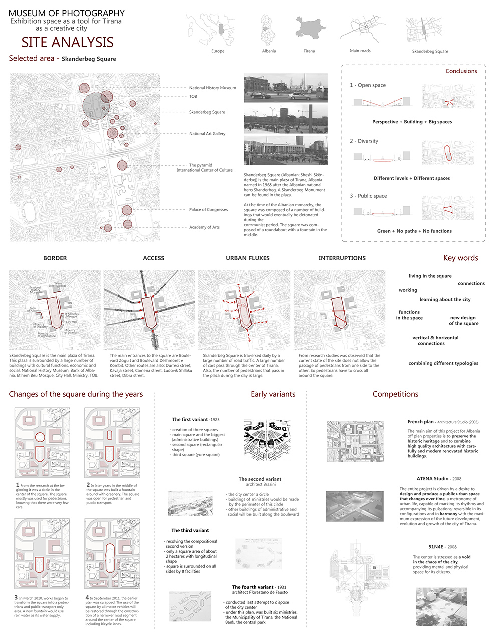
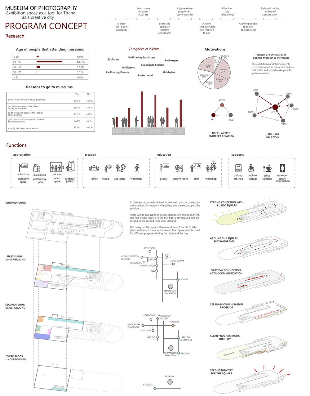
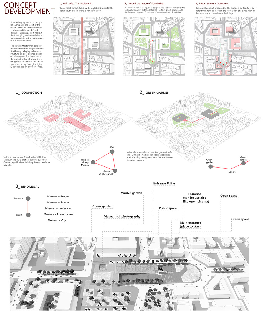
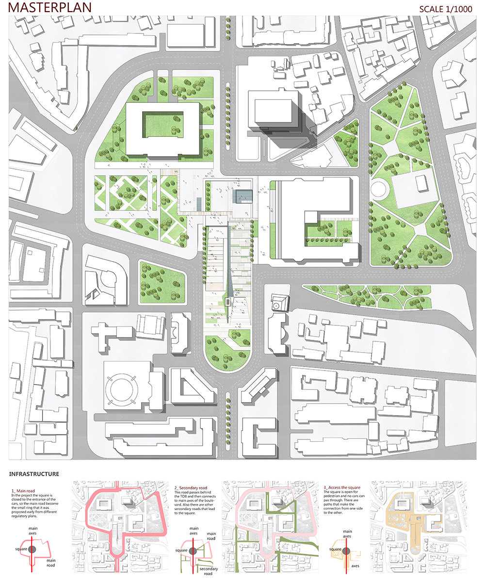
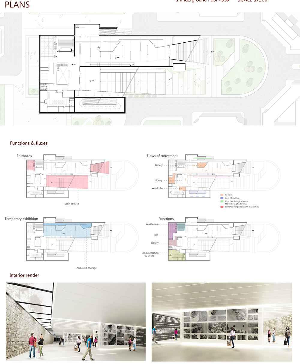
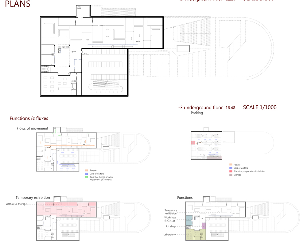
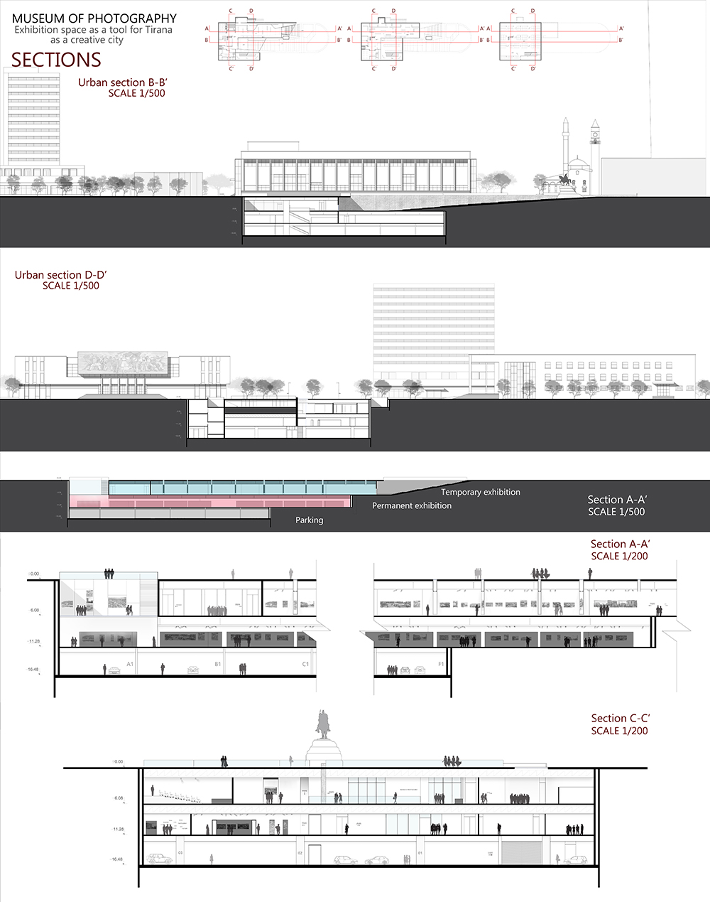
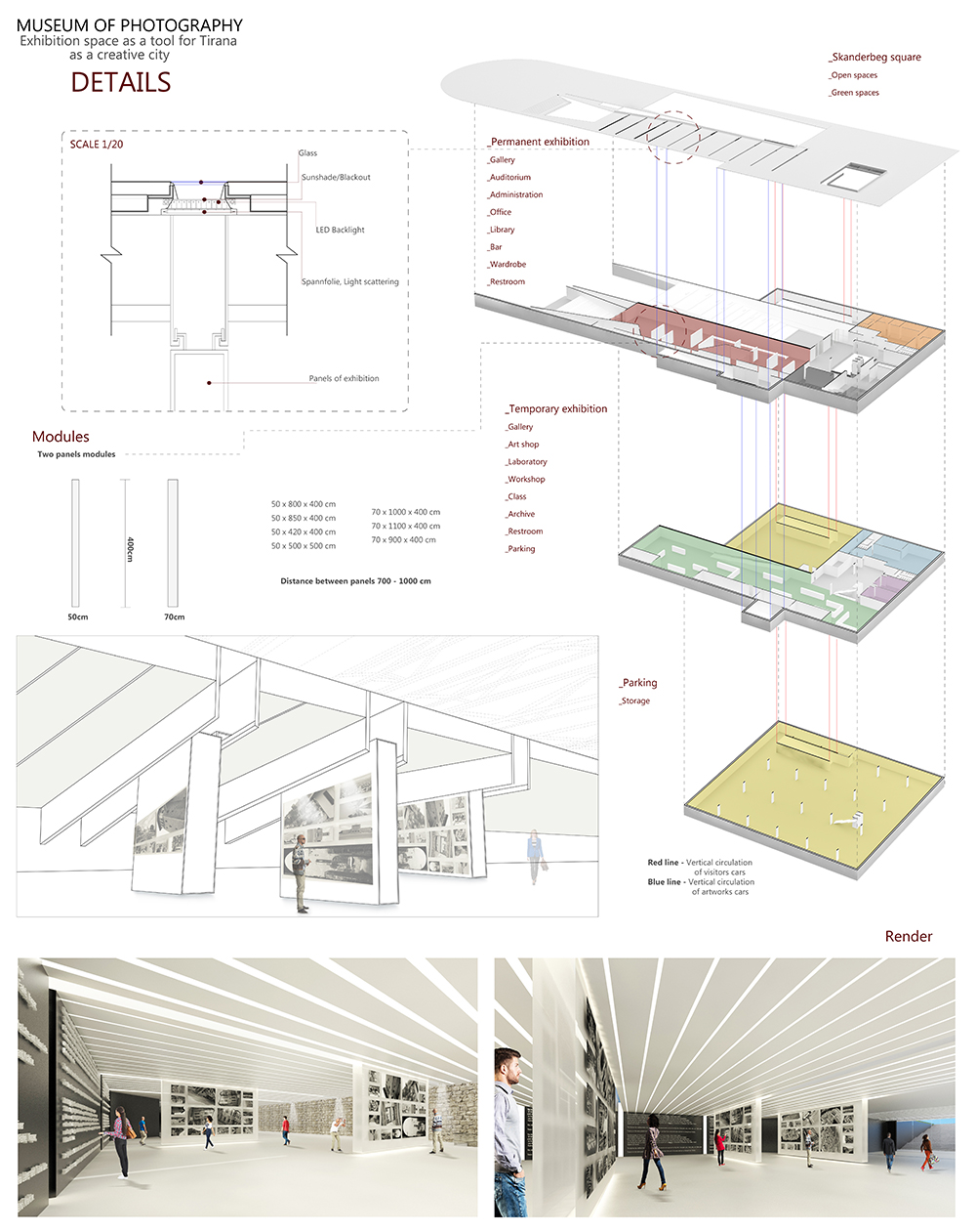
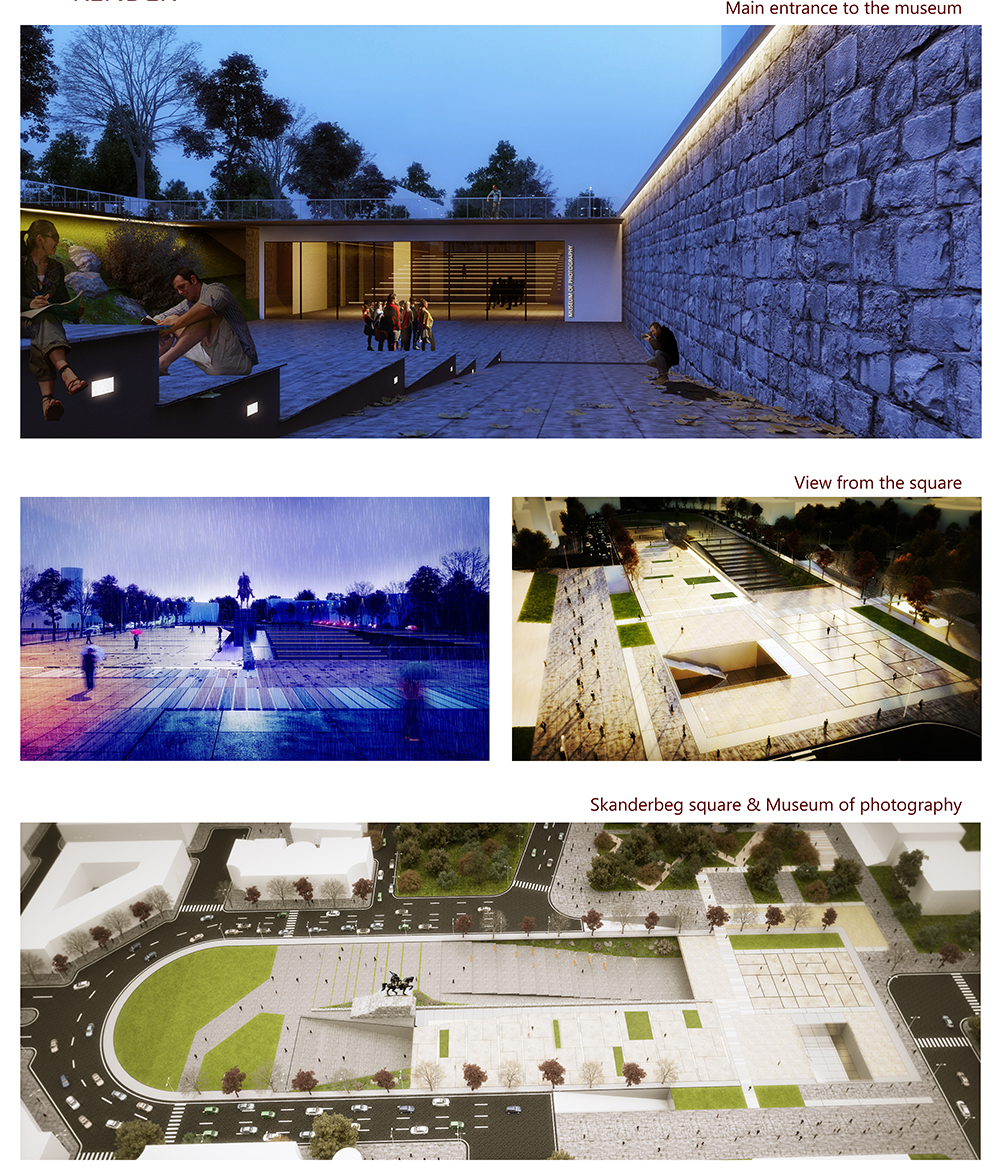
Museum of Photography in Skenderbeg Square Tirana.
POLIS University Architecture and Urban Design Faculty. Tirana
Figali Dharda
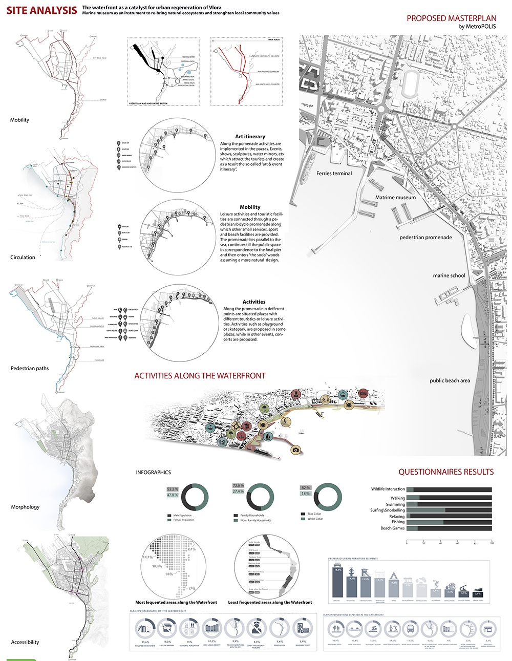
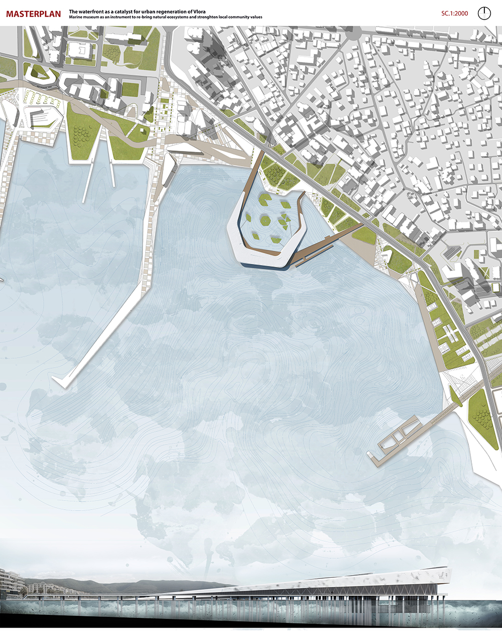
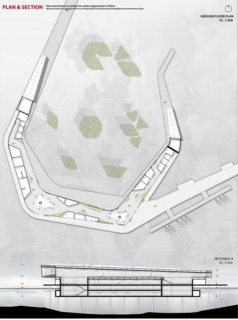
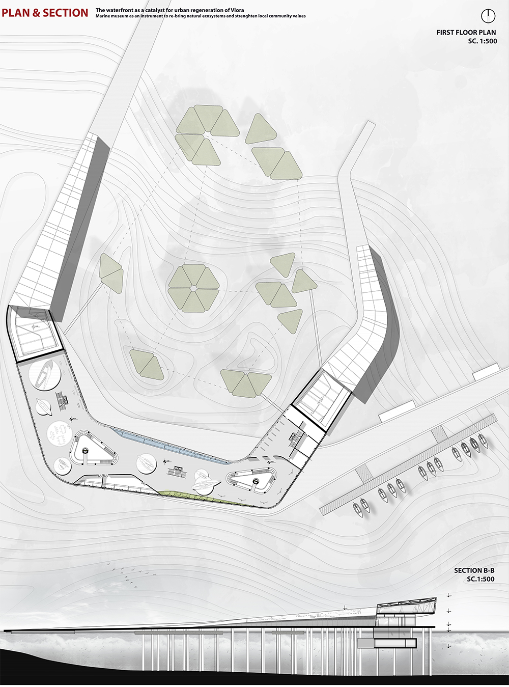
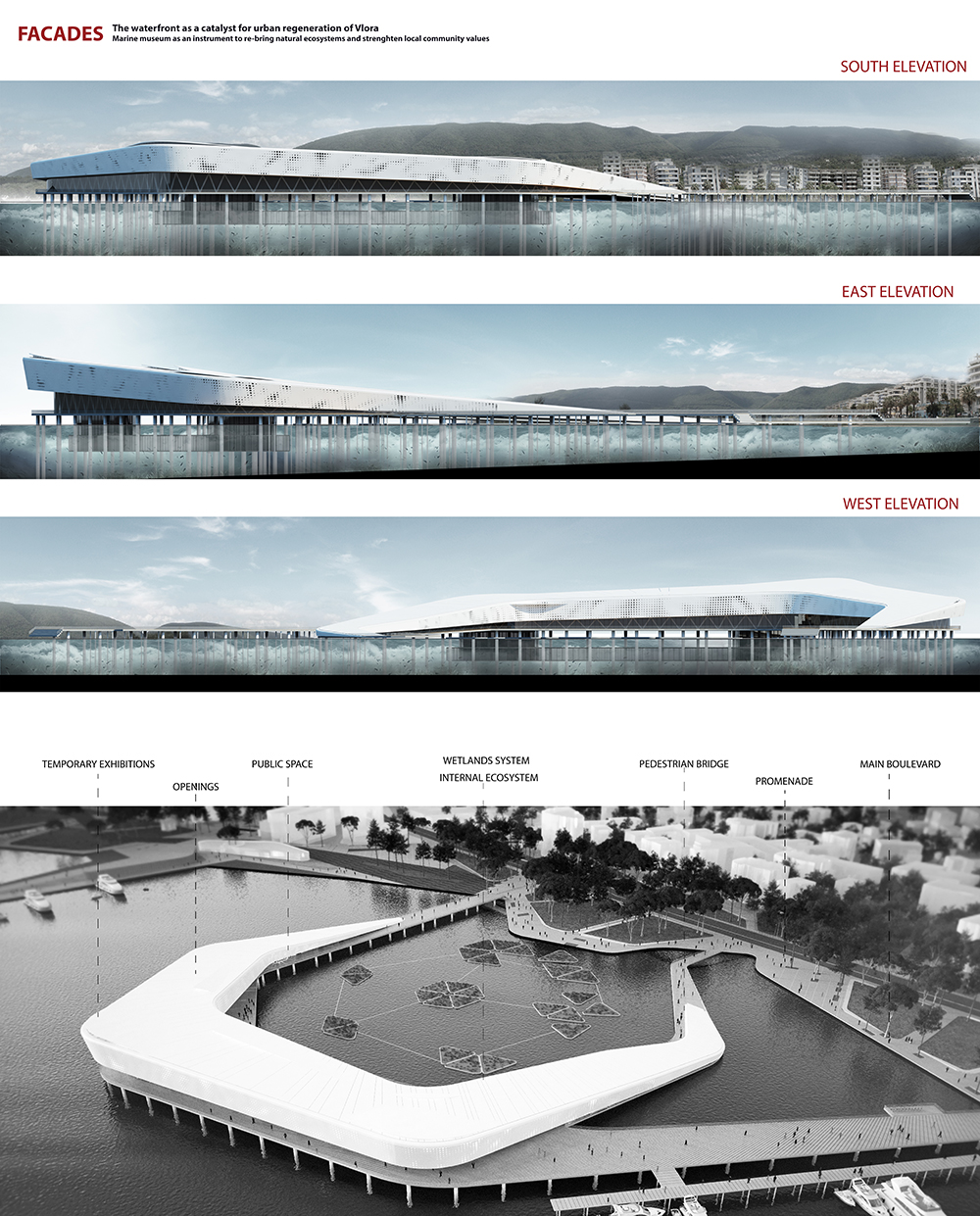
The marine museum as an instrument to re-bring natural ecosystems and strengthen local community values – Vlora Albania
POLIS University Architecture Faculty – Tirana (AL)
Site Position and Analysis
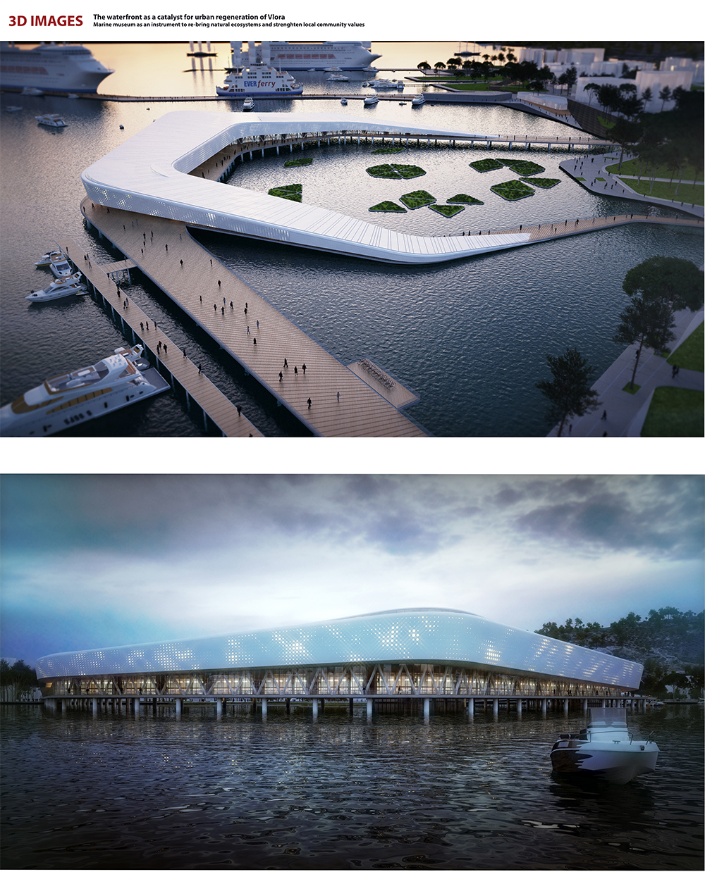
The project is situated in the city of Vlore, which is the second main harbor in Albania. The project area is situated along the waterfront ,which with its added quality, is a good opportunity to broaden some of the functions of the city or to provide new ones for the residential areas, prolonging its activityduring the whole year instead of the current seasonal one.
Taking into consideration the fact that Vlore is the second largest port- city in Albania with the increasing number of inhabitants it should be considered a new centrality in continuity with the old city centrality and with thatof the harbor area (Skela).
The new waterfront is an extension of the city spine, represented by its boulevard. Important functions should be proposed in order to revive the city during the whole year. Beyond the square further important functions must be anticipated; A recreational pole, sport activities, a wellness center and pools; but also smaller activities: Info points; News-Stands, Thematic squares, Playgrounds, Bus Stations, small cafes fishing piers, bathing services etc. What is missing in the existing context are receptive activities, services to tourism and activities that bring the city life in the waterfront not only during the summer but during the whole year as according to our vision Vlora is expanding in the south-eastern part of the waterfront. Referring to the sectors of the waterfront it is possible to define for each area new functions and activities which will give a proper identity to each part of the city.
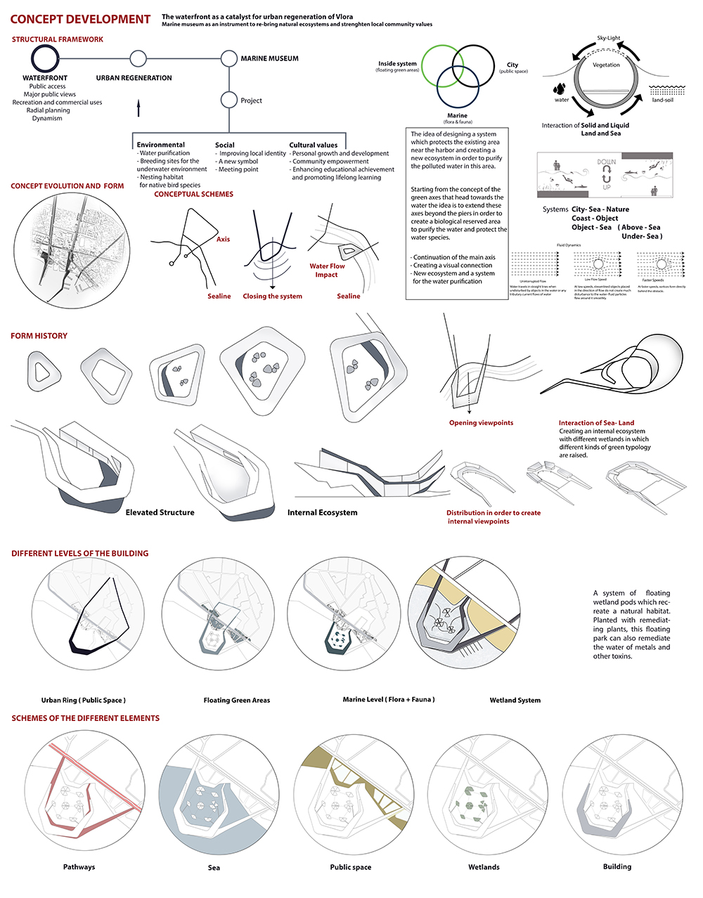
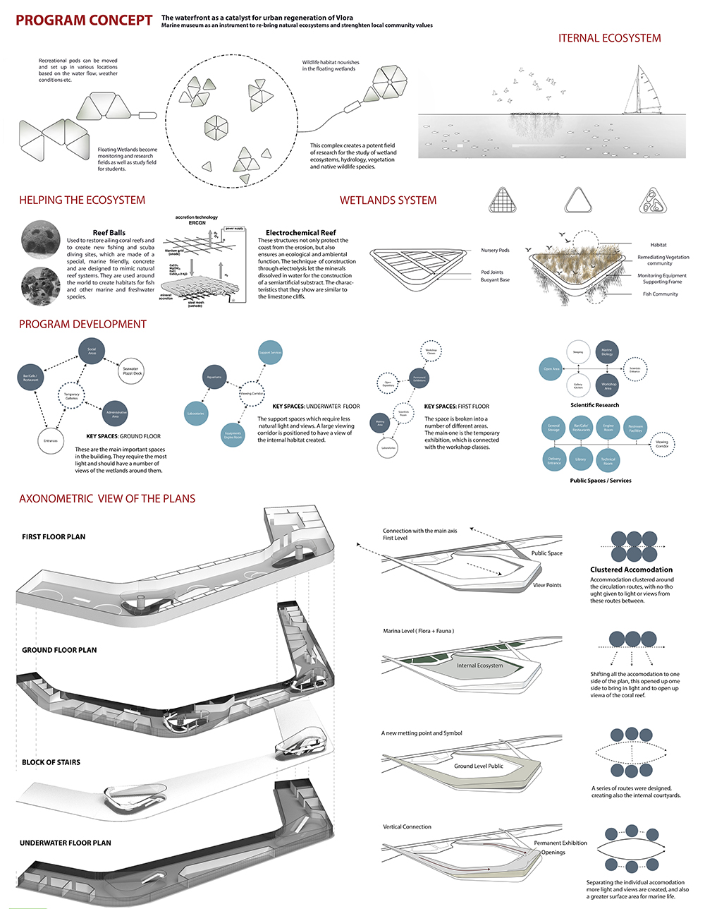
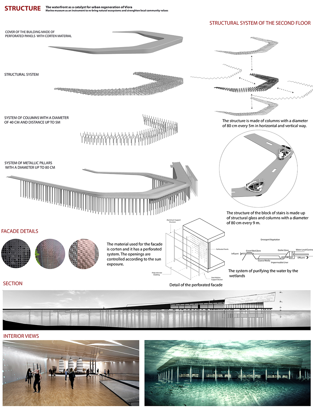
Due to the analysis and questionnaires done in the city a problem that should be taken in consideration is the fact that all the sewages are thrown in the water and sea especially in the harbor zone , which is polluted and can be a reason for many infective diseases. So starting by the concept of the green axes that head towards the water the idea is to extend these axes beyond the piers in order to create a biological reserved area to purify the water and protect the water species. The system of floating wetland pods recreate a natural habitat.Planted with remediating plants, this floating park can also remediate the water of metals and other toxins. This complex creates a potent field of research for the study of wetland ecosystems, hydrology, vegetation and native wildlife species.This cellular system allows for easy maintenance, since each cell can be removed and repaired without jeopardizing the overall health of the network. This marine museum creates a whole new system which protects the zone and has three levels. It proposes a visually powerful and highly efficient transport and public facility that connects the two axis of the city proposed in the new masterplan with the impressive waterfront.The second is the marine level, which connects the city with the underwater flora and fauna and the third is that of the more green nature,which connects the internal ecosystem with the existing one in the city.
The Museum is set back from the water’s edge by an esplanade with a covered pedestrian loggia that allows visitors to enjoy the view across the bay. At night, when viewed from the water, the glassy facades of the Museum will reveal the brightly-lit interior, becoming a beacon on the water and a landmark on the horizon . The Museum and Marina are thematically linked to the outdoor Marine Life Park and form a rich tourist experience focused on the sea, marine life and maritime experiences.
The concept needed further development, so by analyzing several proposals, an interaction of both elements, a symbiosis of these opposite essentials was needed . Thus, the design is basically an interaction of solid and liquid, land and sea.
The cantilevered architecture provides not only a sense of architectural spectacle and event but creates exciting vistas and public spaces for both visitors and locals alike. Within the building’s curvilinear architecture are numerous exhibition and event spaces, night markets, cafes and restaurants. These public programs are all integrated carefully with the architecture and the landscaping of the site and surroundings to create a vibra nt addition to the new green edge of the waterfront.
Construction
The building’s structure is made up of advanced concrete and steel structures. The building’s architectural facade design forms the basis for the design of the steel structures. The concrete structures around the aquariums are exposed to an aggressive saltwater environment, which imposes extreme requirements on the structures’ lifetime and corrosion protection. A complete experience of life in fresh- and saltwater across the earth is created . The concept involves the visitor into an underwater universe with an atmosphere that will fascinate and enchant both children and adults. The exhibition is a total concept offering all visitors a captivating experience of life in and under the water. A mixture of light, sound, projections, film, interactivity, graphics, illustrations and signs aimed at all age levels ensures that every visitor, regardless of background or interests, has the best experience possible. Moreover, the concept sets new standards for aquarium facilitation and design.
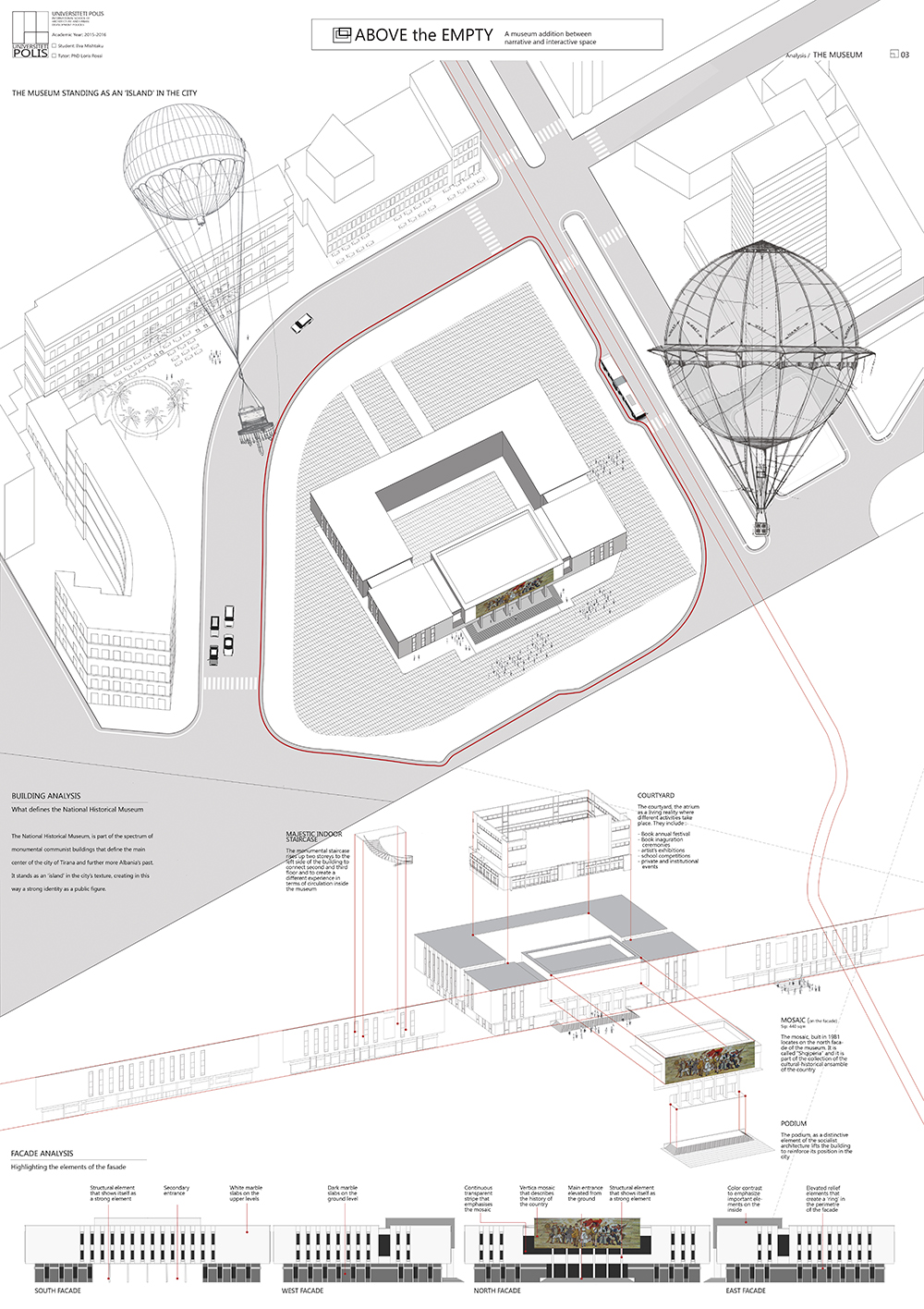
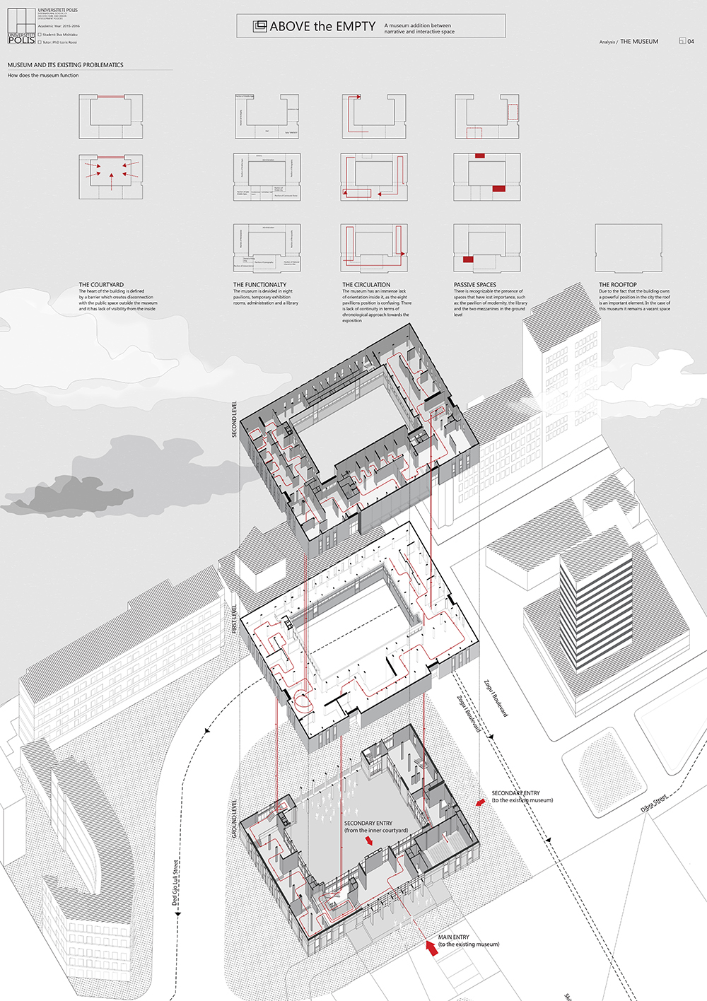
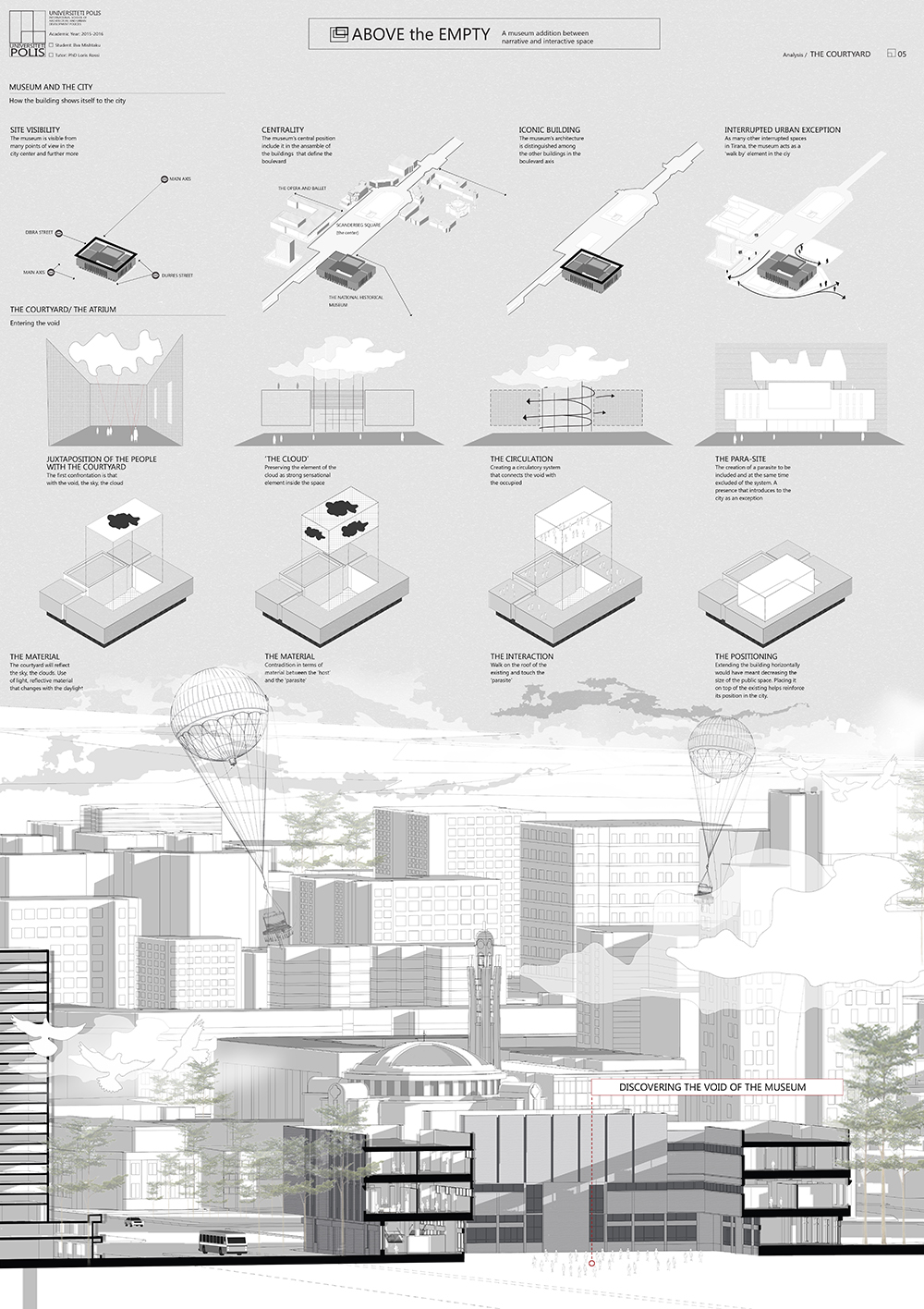
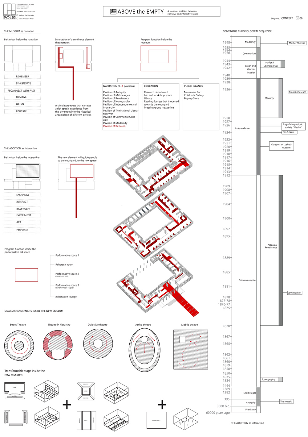
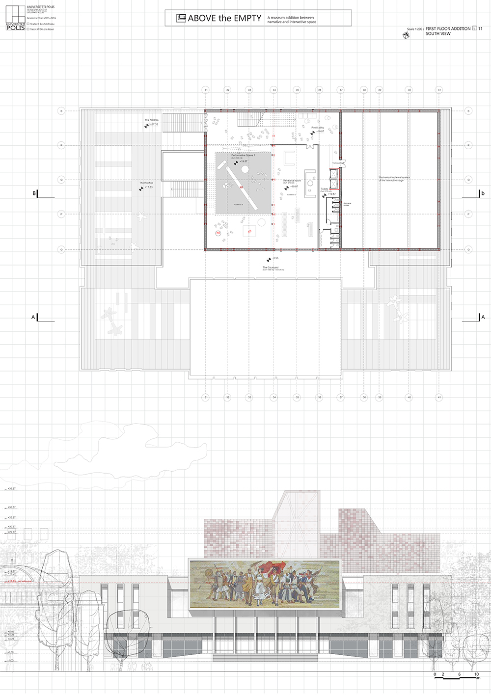
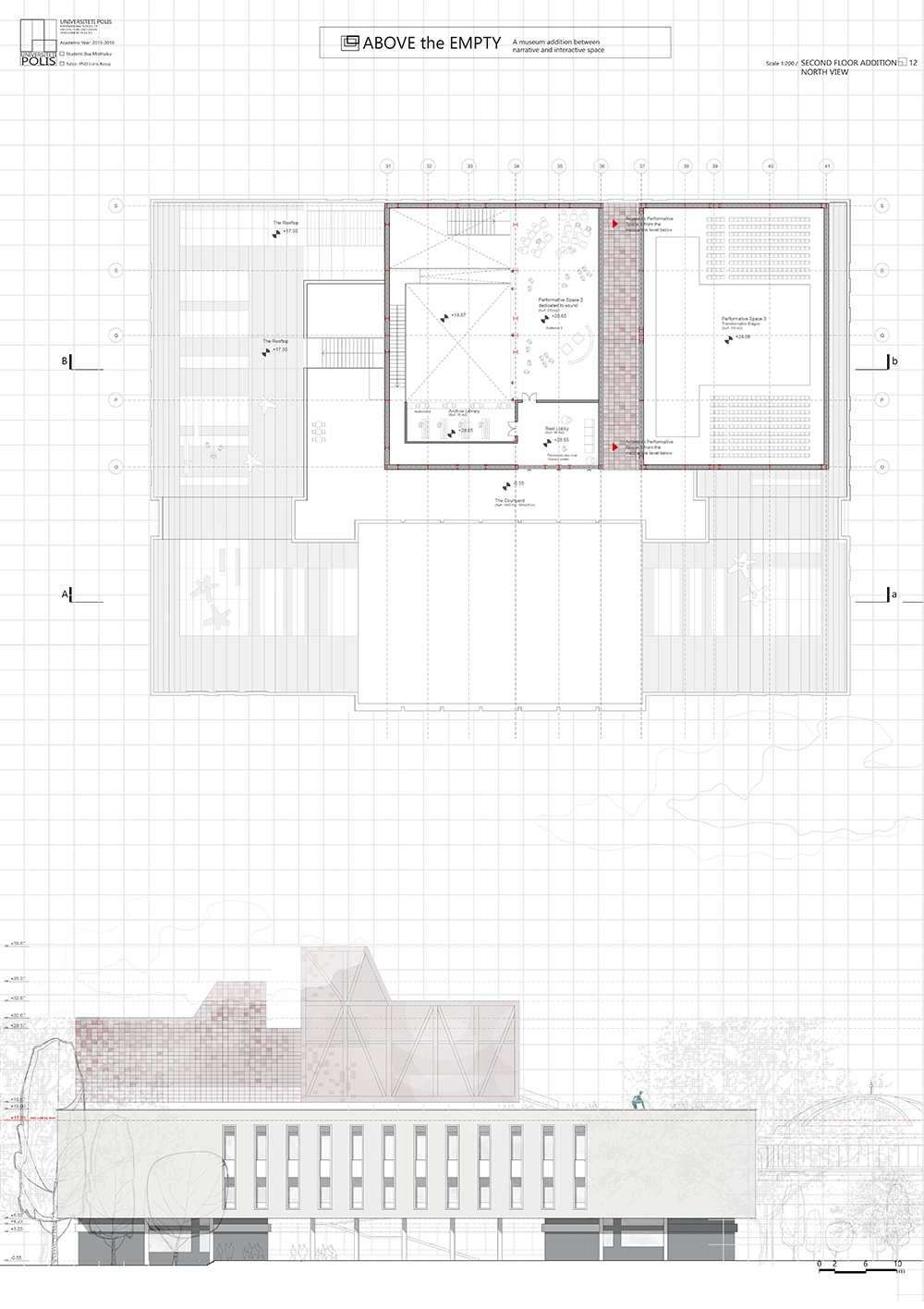
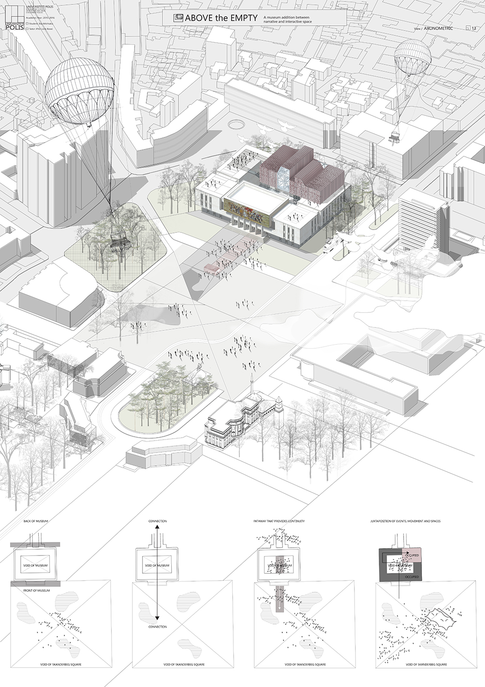
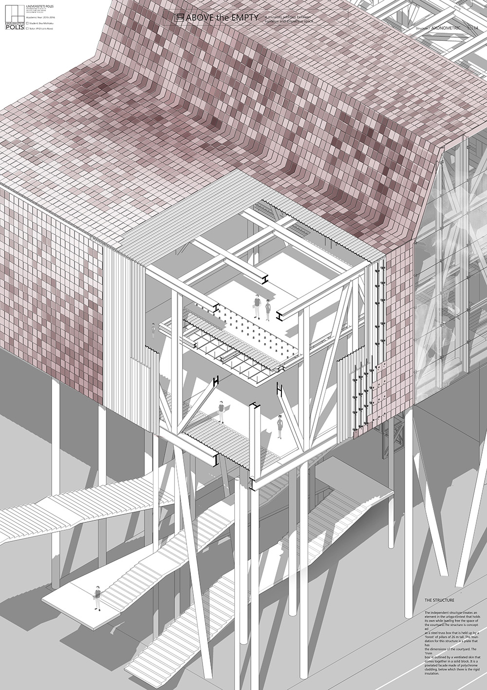
Ilva Mishtaku
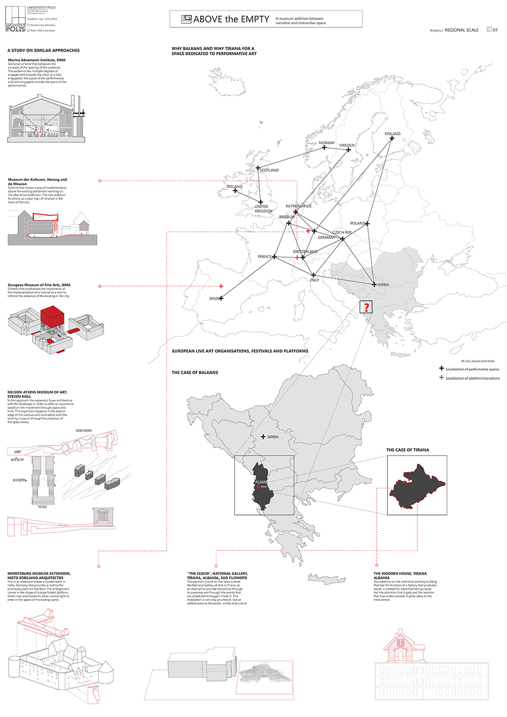
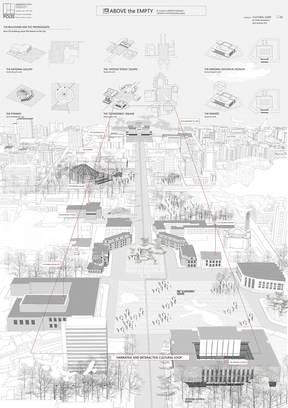
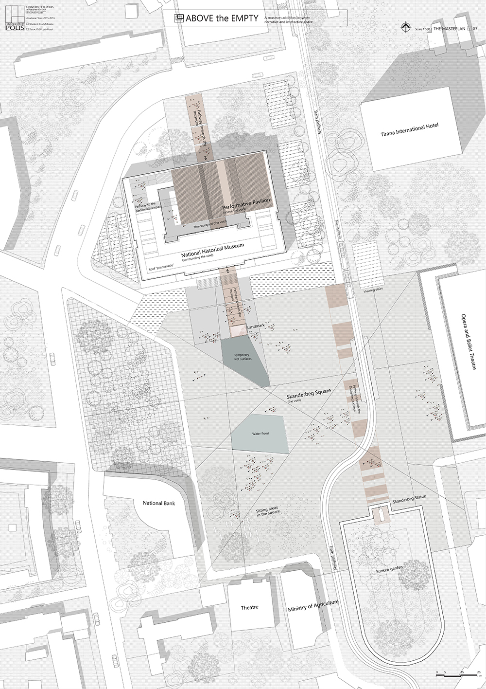
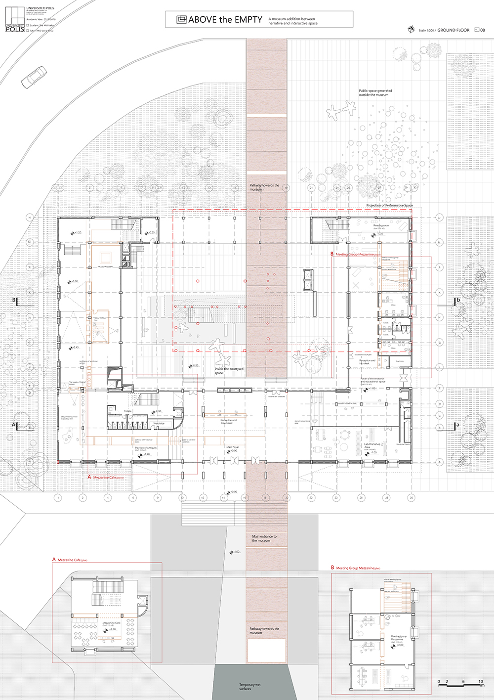
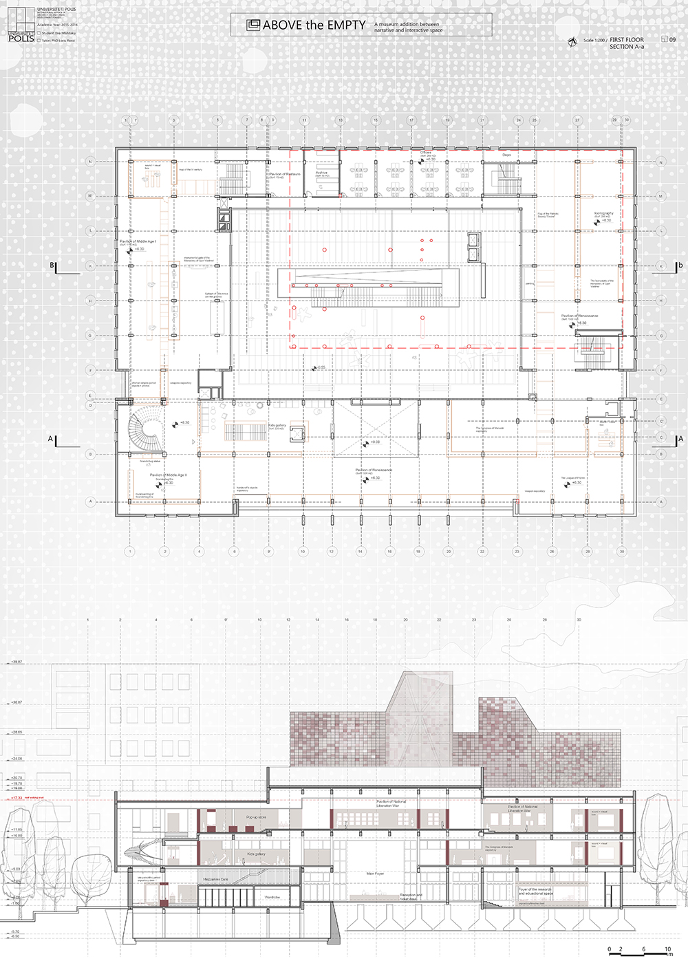
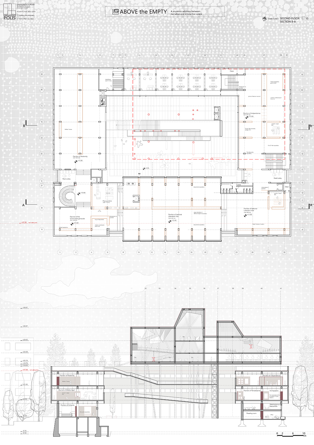
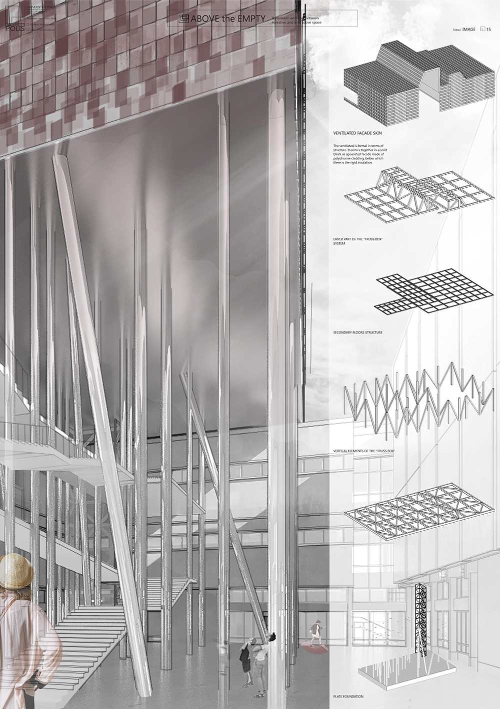
ABOVE THE EMPTY
Rewriting our social and historical narratives through the flexibility of the art of performing
POLIS University Architecture Faculty – Tirana (AL)
Structure Consultant: Besart Gjana
Concept:
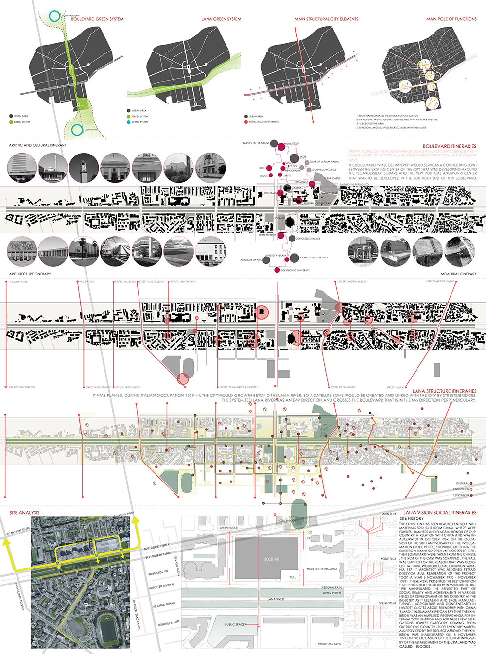
The analysis provides for an inspiration, from which derives a concept that embraces the idea of trans-programming. As explained by Bernard Tschumi in his book “Architecture and Disjunction”, this means to blend together two functions that are completely different to each other and at the same time co-exist, and further more improve the functionality of one another. The concept elaborates the idea of contradiction on how will the two components describe themselves to the people. On one hand there is the existing museum which is presented as a ‘narrative’, while on the other hand stands the intervention which manifests as an ‘interactive’. The ‘narrative’, the museum, will work on the concept of a continuous chronologic sequence that can be sometimes cut out, enclosed, extended or diluted. On the internal space configuration of the existing museum a new system of narration will be implemented which is not only chronological but also physical. The relation between the two systems will be similar to the relation between ‘the host’ and ‘the parasite’. Inspirations for the concept come from the feedback from the site (fig. 42). After discovering the void, the courtyard, the first juxtaposition to it is the one with the sky. It immediately gives you the idea of being embraced by the lightness of the clouds. Therefore, the Performative Art space, is conceptually thought as another cloud added above the void of the courtyard.
Alma Hoti
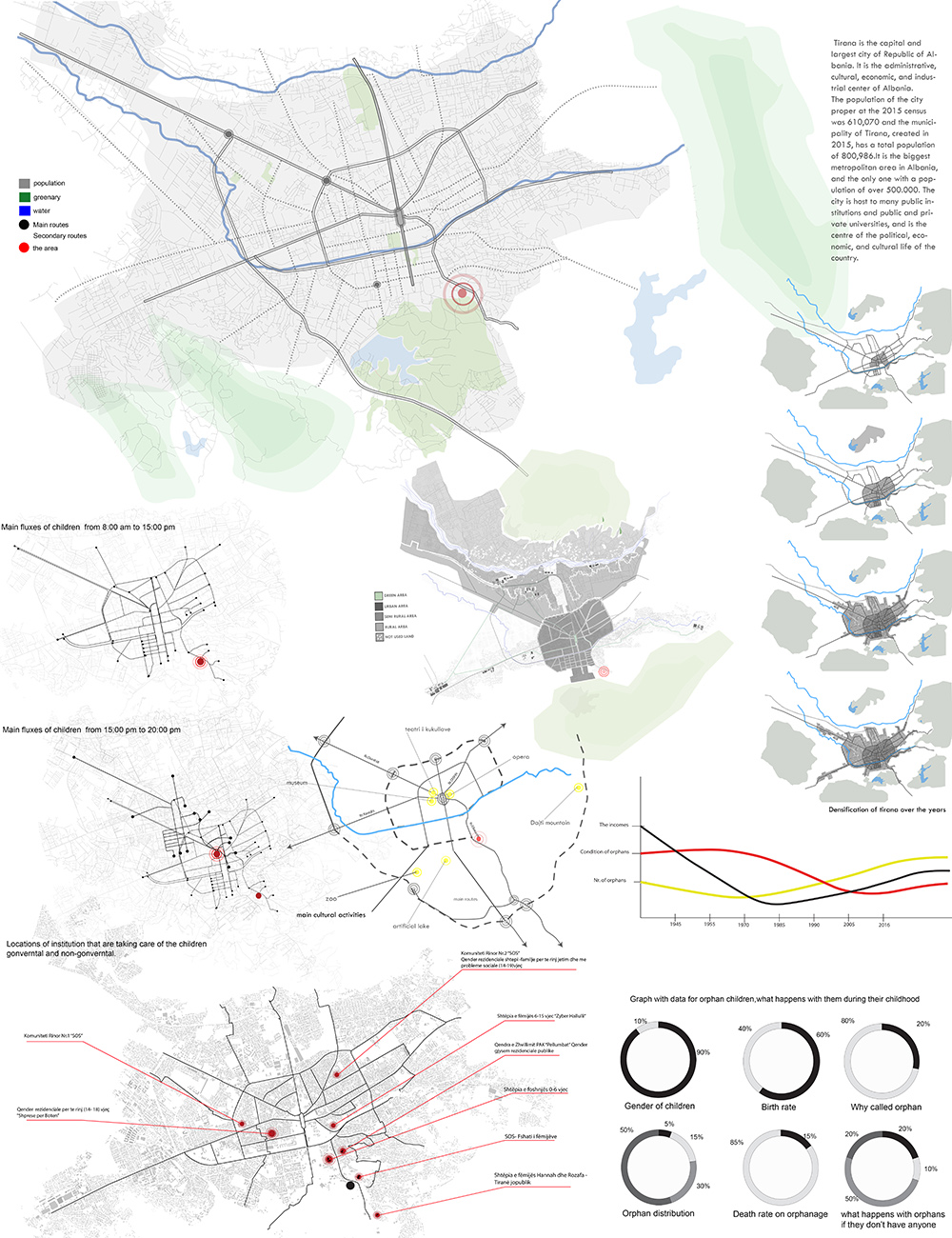
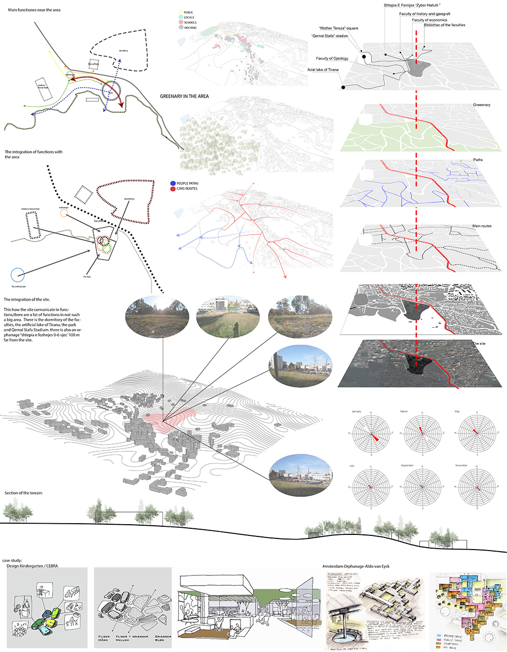
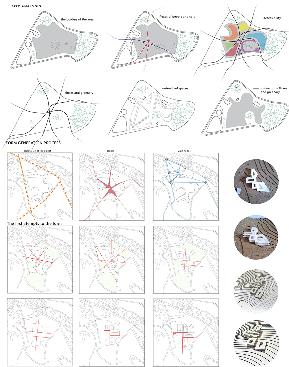
Nurturing steps – A multipurpose center for orphans in Tirana
POLIS University Architecture Faculty – Tirana (AL)
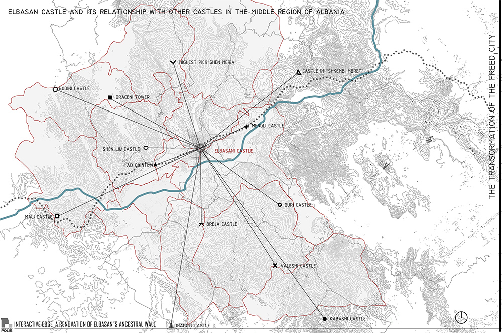
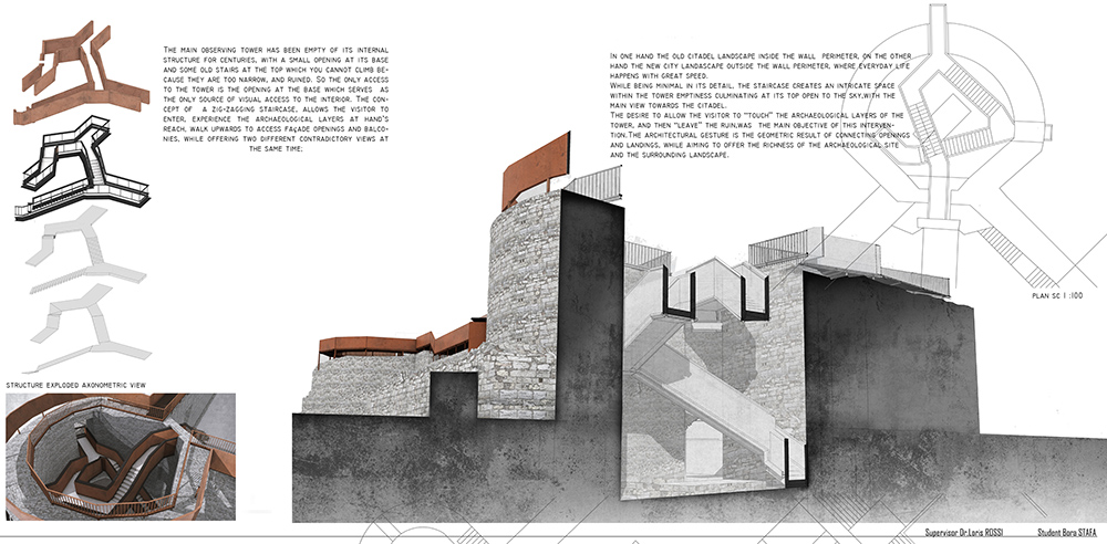
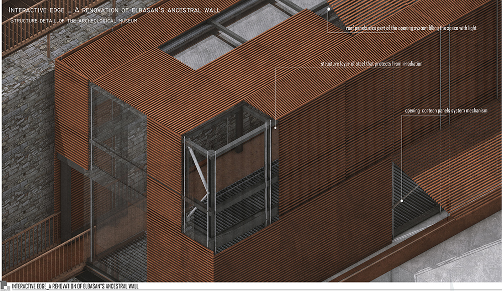
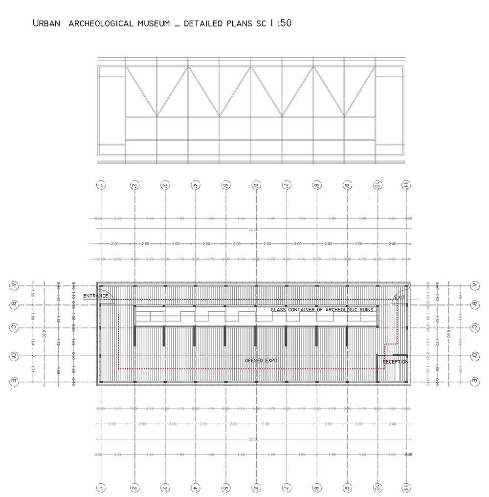
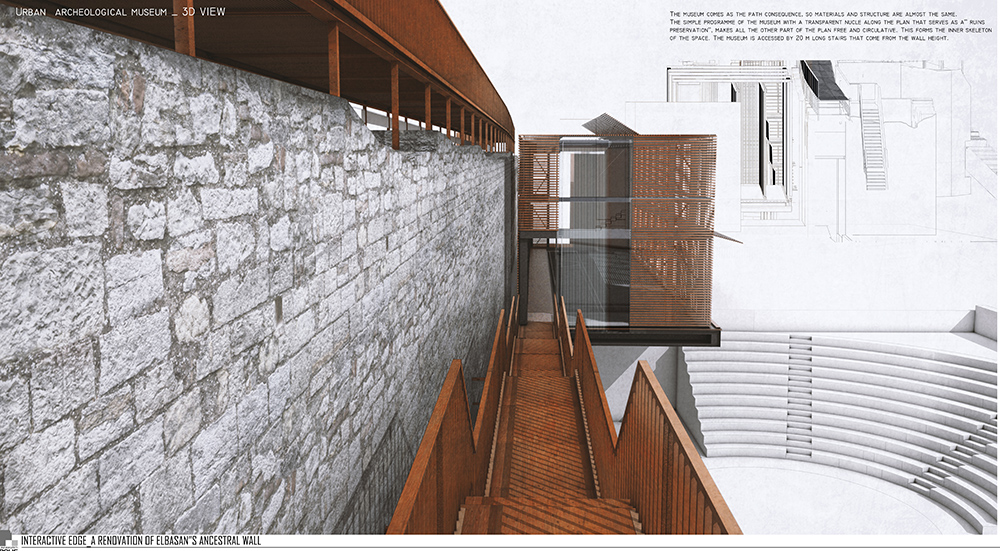
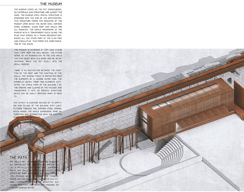
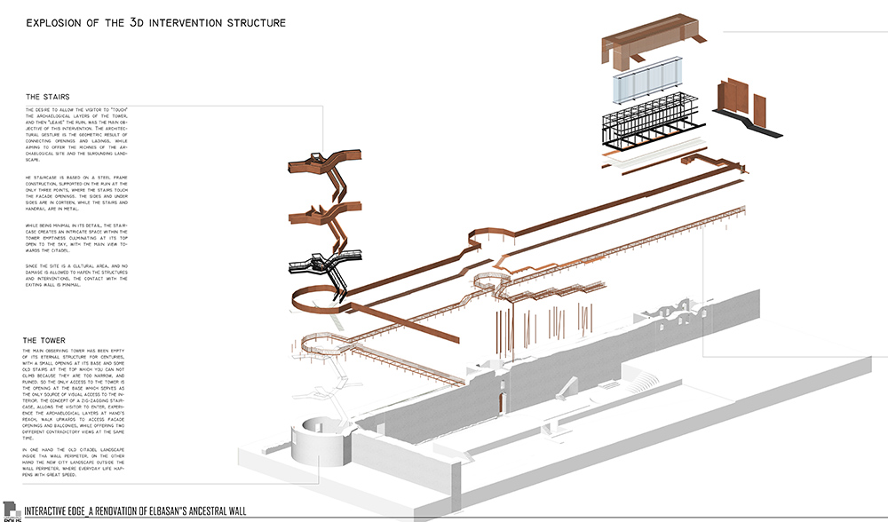
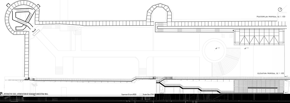
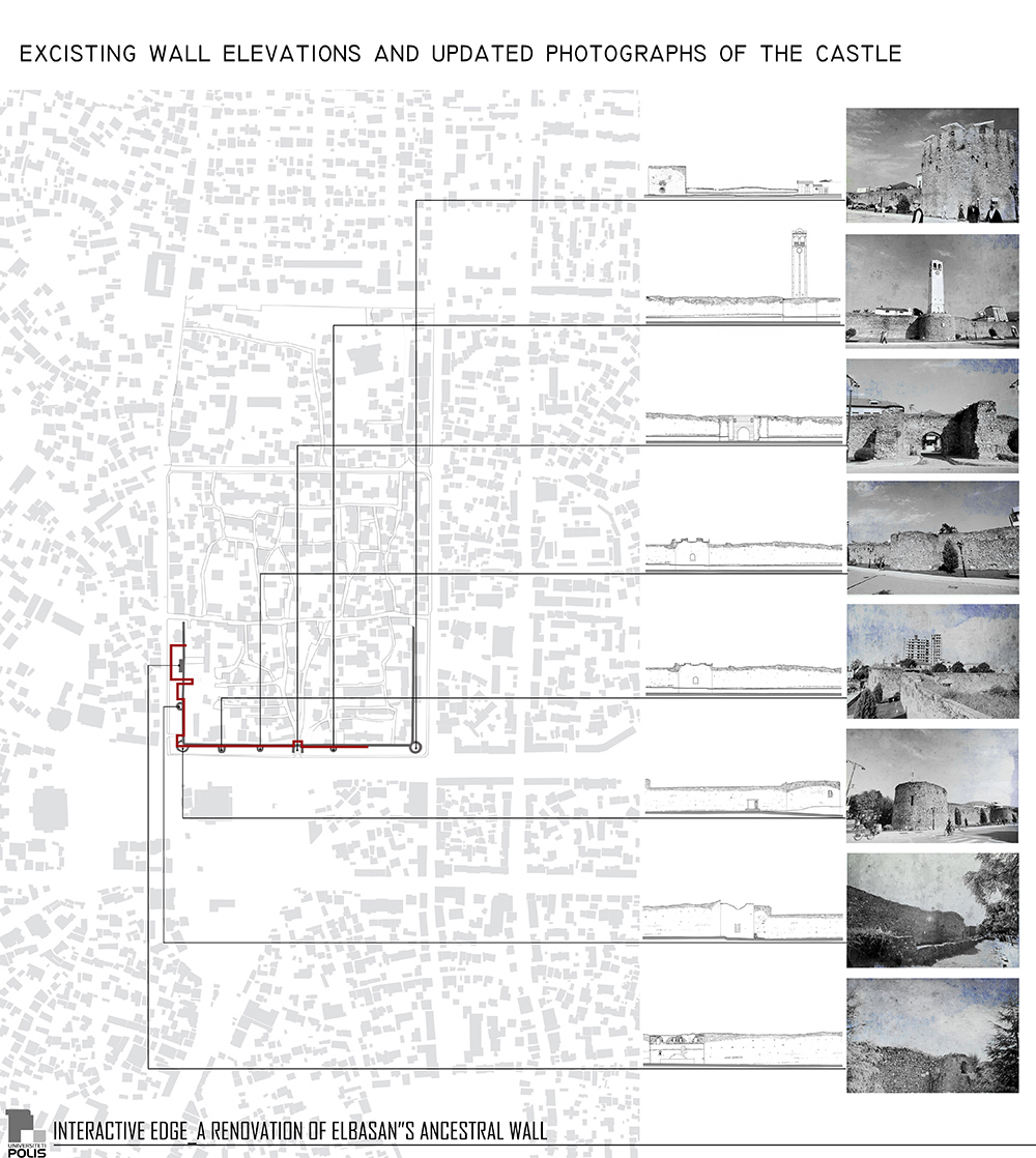
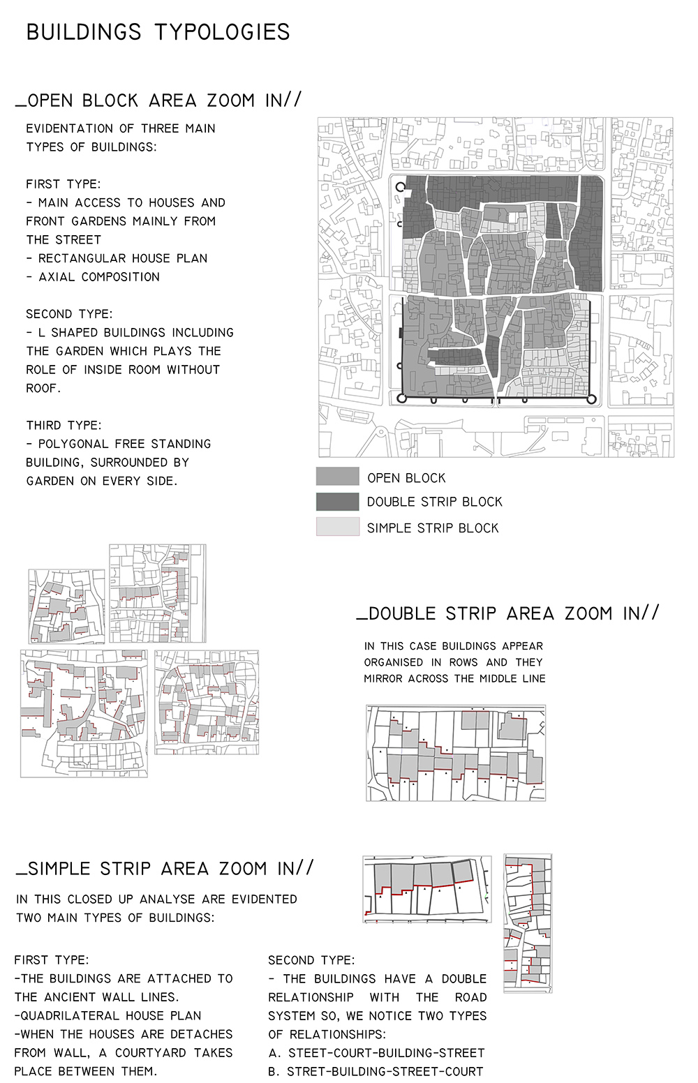
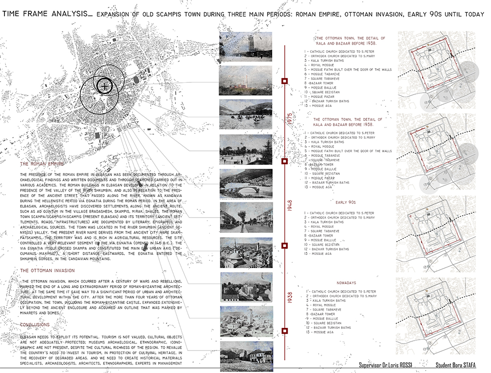
Bora Stafa
INTERACTIVE EDGE
A renovation of Elbasan’s Ancestral Wall
POLIS University Architecture Faculty – Tirana (AL)
Concept from the thesis report:
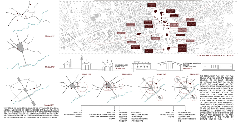
ELBASAN _ THE LOST IDENTITY OF A CITY
The main purpose of this project is to experiment new experiences of the old city considering it as an urban object and most of all a cultural object, not only a creation of the human society but also aesthetic, carrier of universal values, that are inherited and transmitted from generation to generation. More than any other architectonic isolated object, the structure of the urban settlements has resisted time, a structure that has accepted change, transformation and development from time to time. When we realize studies in the morphological field, this does not mean that we should copy from tradition and the forms of the past, but, it means we should find the ways that these studies serve to distinguish principles and experiences through the understanding of the concepts, models, and theories that analyse the human environment.
This is possible by studying the environment from two perspective:
In one hand there is the city as a long creative process
The other hand the study of the city as a product of this disciplined process.
Staying with the idea of this study, it is to be pointed out the fact that we are going to concentrate in the analysis of the values of urban situation of the city of Elbasan before 1960,a time that sets a clear limit between the city from the past and the first interventions in its urban structure from urban planners that tried to respond to the necessities of time.
First of all it is distinguished the sustainable strategic, geo-morphological and economic principles that have determined the position of the city of Elbasan. Secondly, it is the stability of the urban structure of the city, visible and present now days in the plan. This structure was consolidated in long periods of time accepting as non conditional phenomena:
-Evolution in time and the territorial expansion through an organic logic, but also, by overcoming the geographic and natural barriers.
-The urban structure, protecting her identity accepts change, adaption and transformation as indispensable conceptual elements of the urban form in her efforts to respond to the phenomena of the social and urban life of the city.
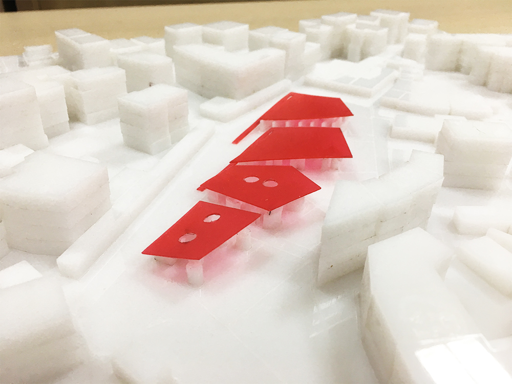
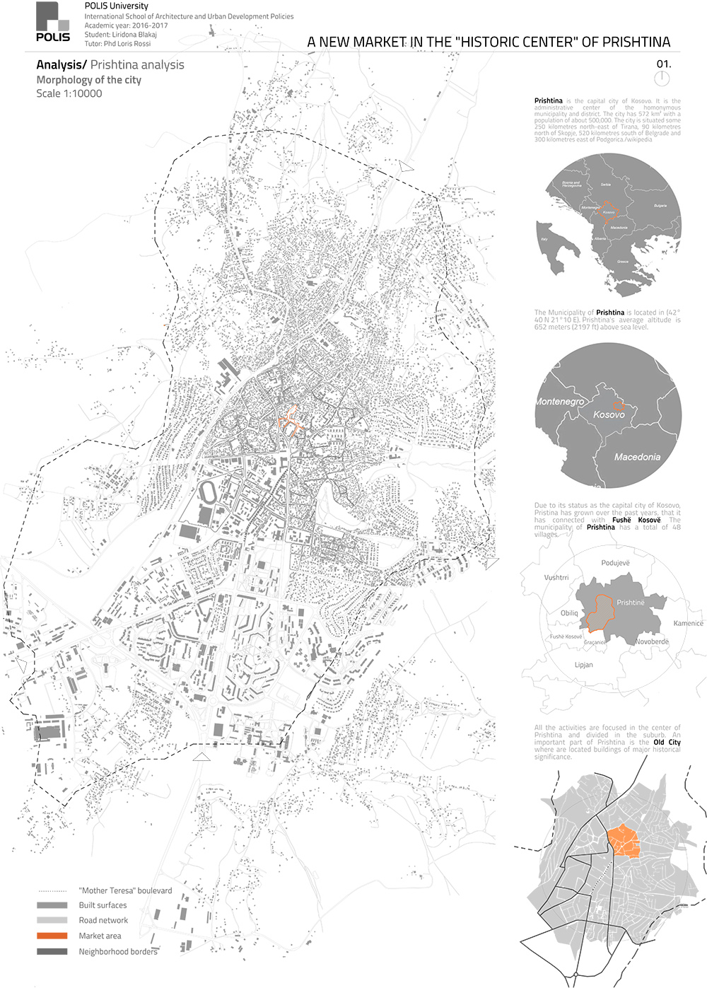
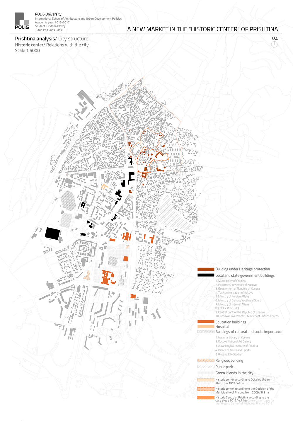
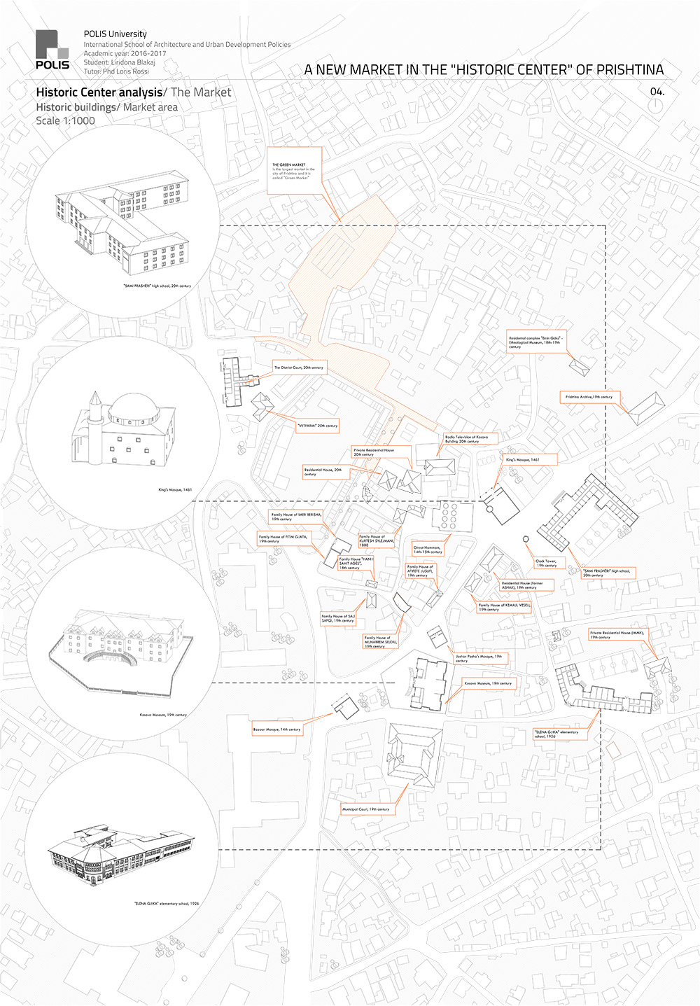
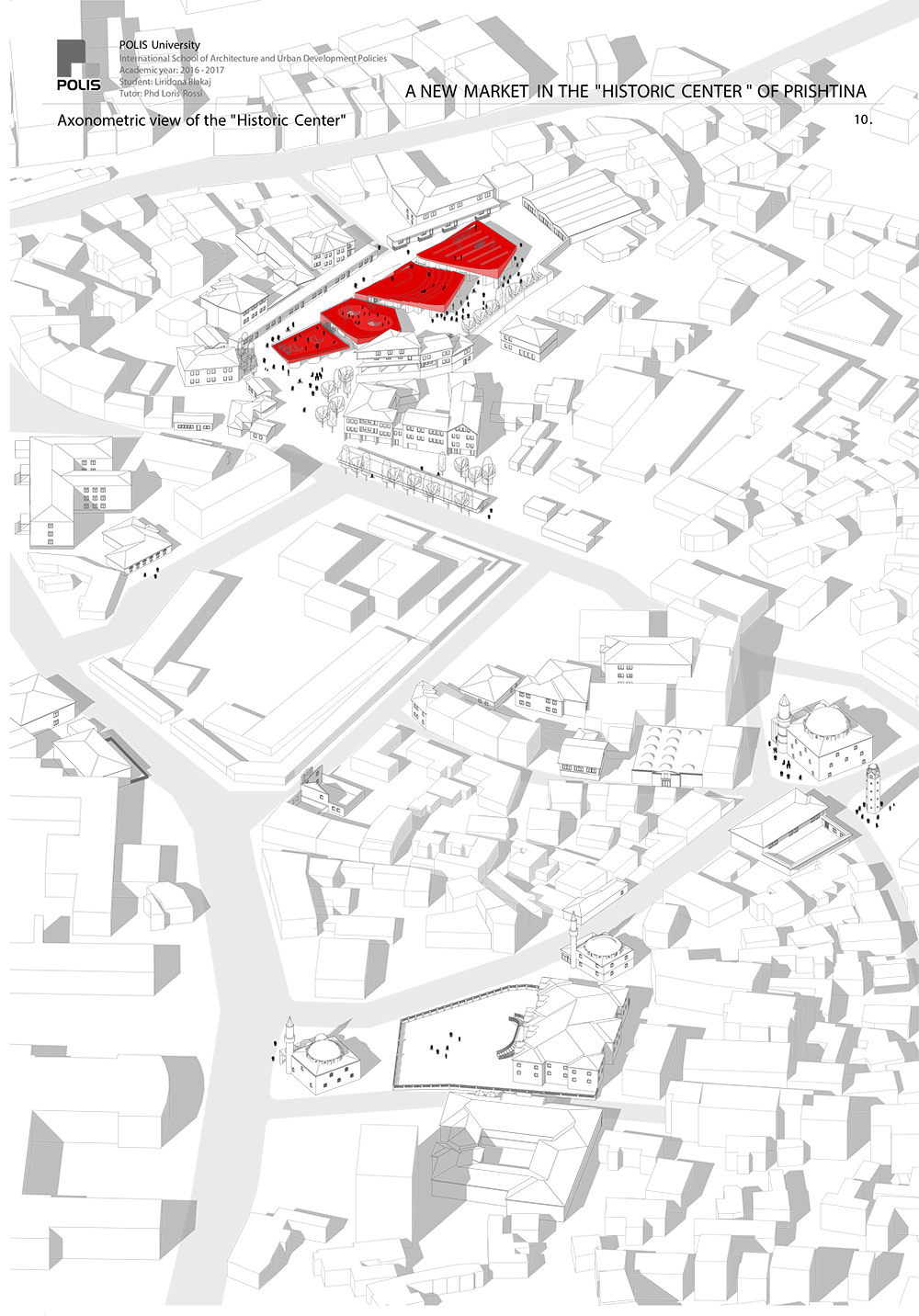
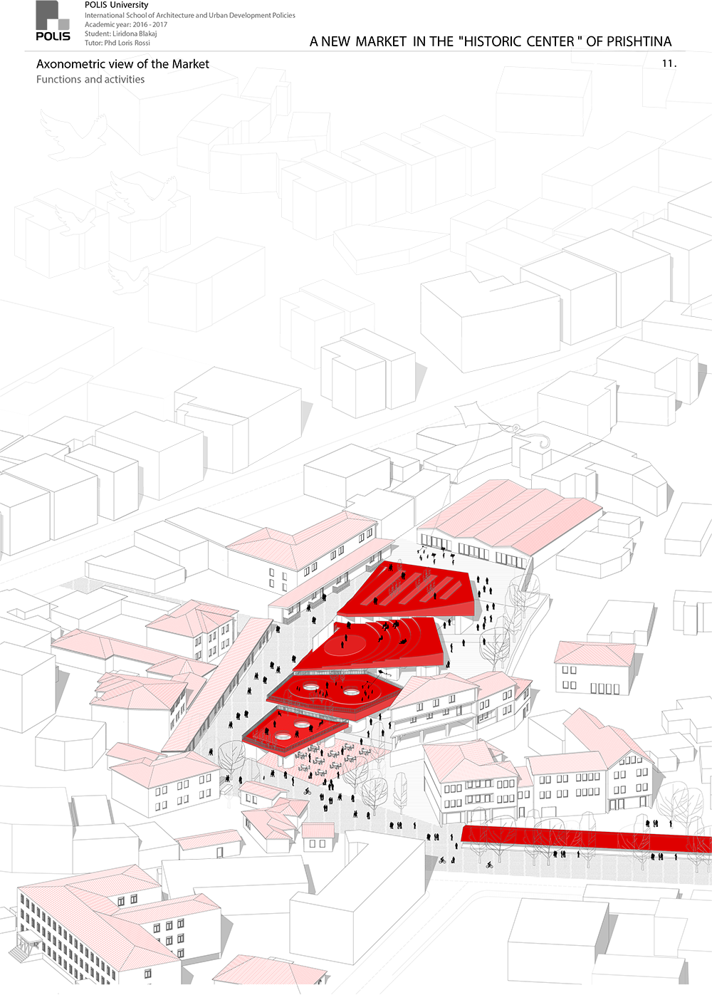
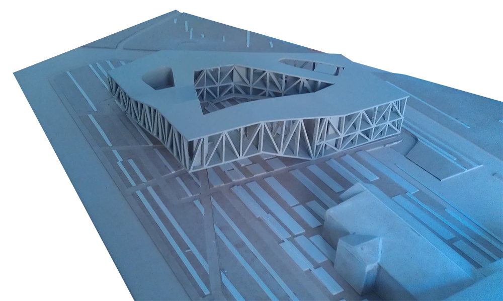
Liridona Blakaj
A NEW MARKET IN THE HISTORIC CENTER OF PRISTINA
POLIS University Architecture Faculty – Tirana (AL)
Concept from the thesis report:
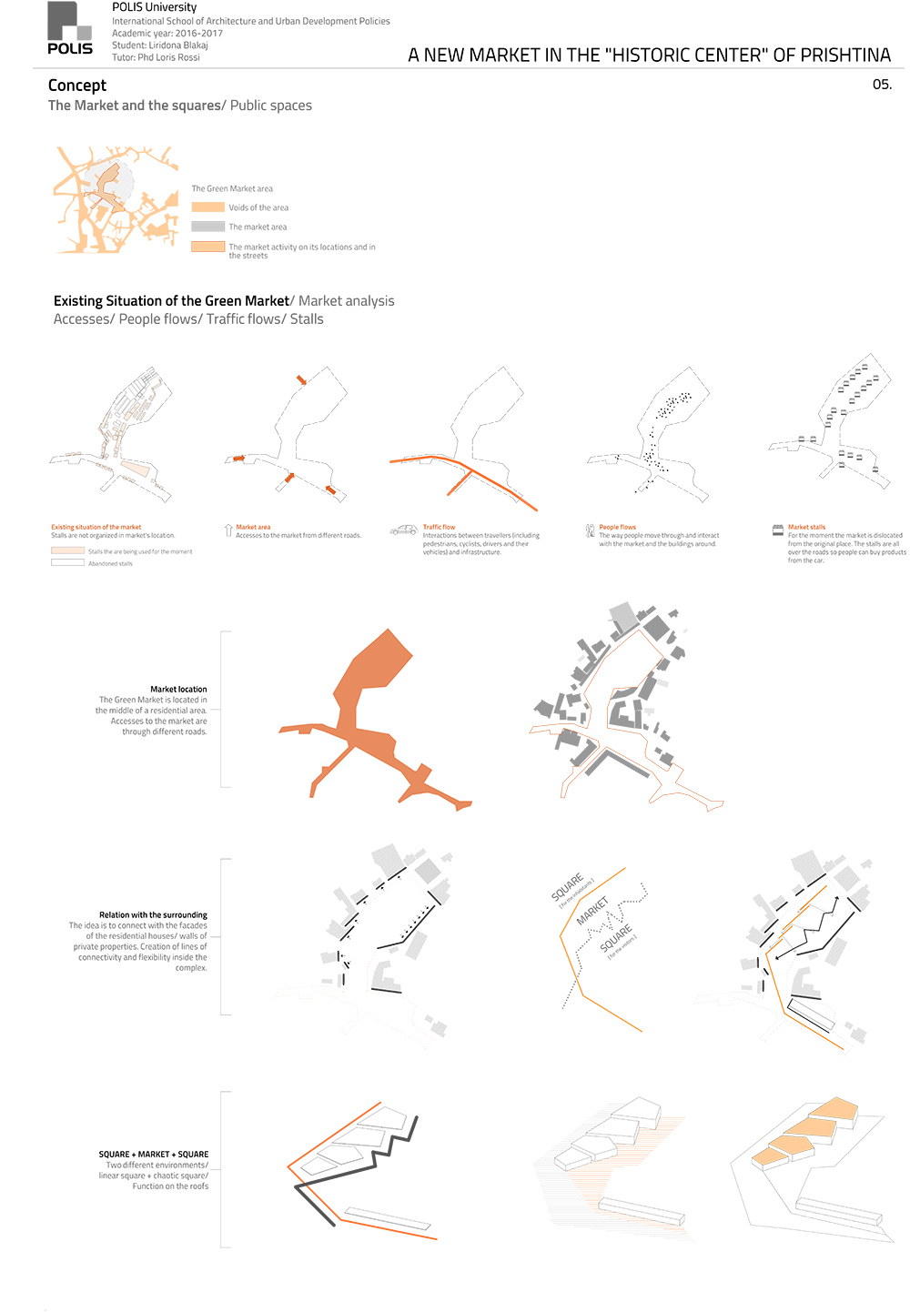
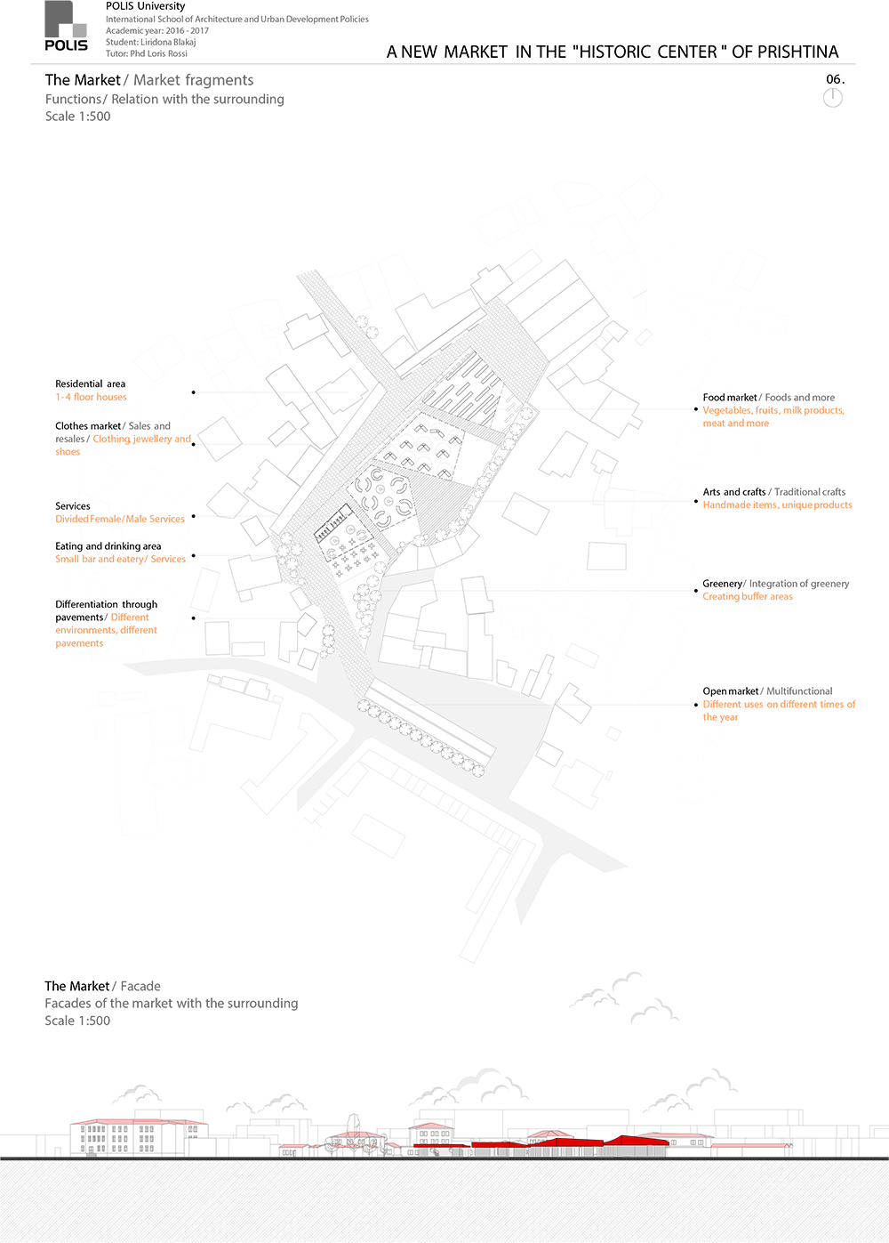
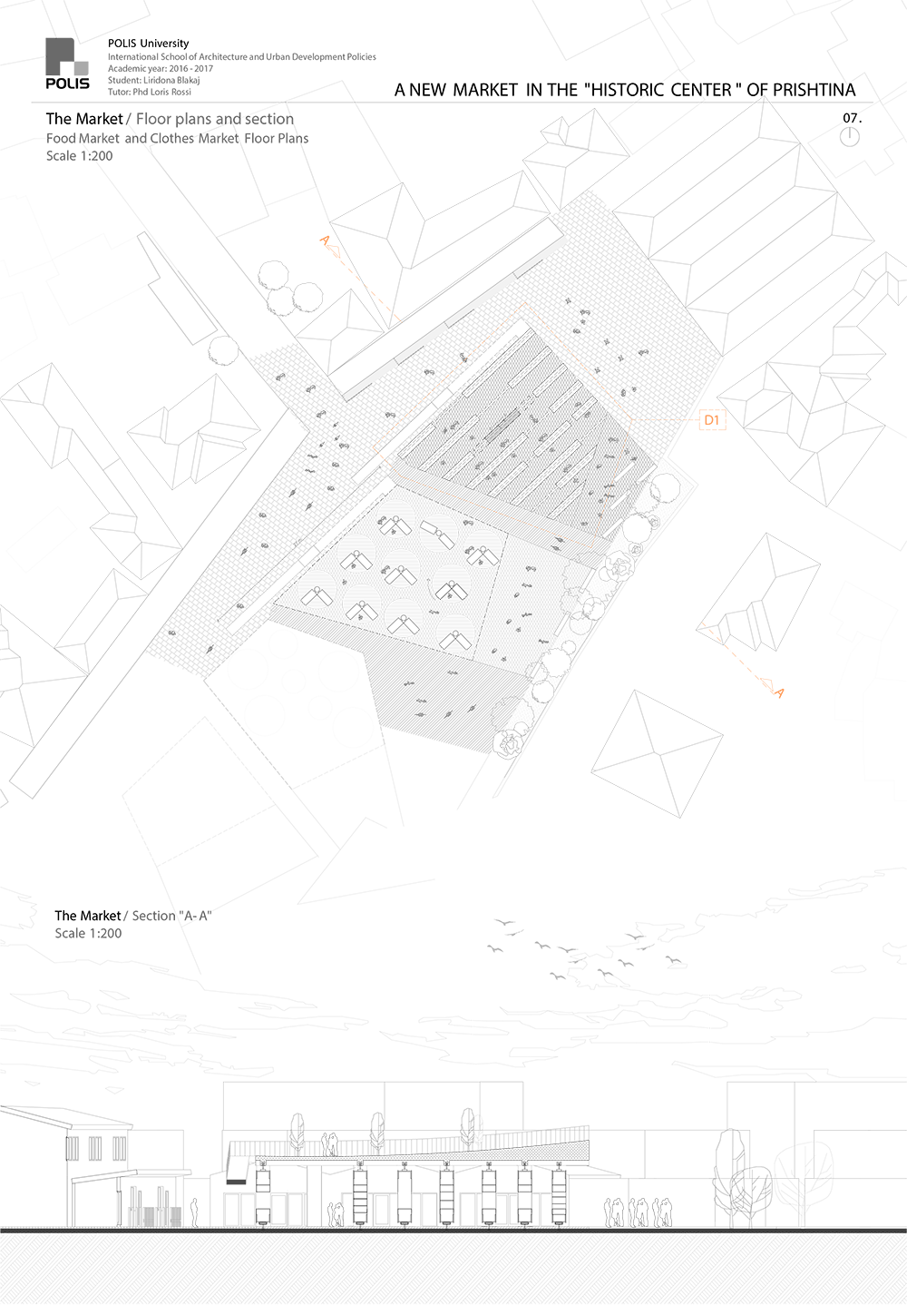
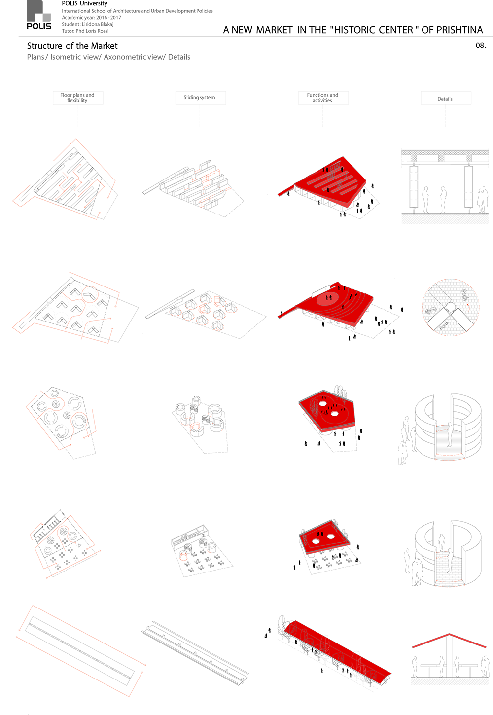
The concept derived from the analysis and it embraces the idea of flexibility. The idea of this project is to create a useful space for the community. This space is a multifunctional area with different functions included inside its perimeter which at the same time co-exist with each other. The idea is to create various atmospheres inside the site, to promote social interface, to attract a larger community inside the city, to make more enjoyable the trading process and to give a landmark to the city. The walking lines treated with different pavements from the main entry of the market lead to the market, which is designed in a way to connect and in the same time to separate the two environments. One line goes behind the structure of the market to a very linear and quiet public space created for the inhabitants around this area and continues with the ramps that guide to the rooftops. The roofs of the market are projected to be mini-squares with various functions; the first one is a garden, the second is an amphitheater, the third is a playground for the children and the last one is a little square. On the other side takes place all the chaos and people fluxes. The inside spaces of these structures are designed in a flexible way, the stalls of the market are transformed into sliding panels which make possible for the traders to create their own spaces. These panels are arranged differently in every fragment of the market so this space can be experienced from people in many ways. Moreover, the market is divided in five fragments:
- Open air market
- The food corner
- Arts and crafts market
- Clothes market
- Food market.
These fragments are assembled in a way to connect with each other, with the residential buildings around and also with the morphology of the city of Prishtina. After all, the market is a place for the people and people are those who give life to it, so this project aims to give back to this place the soul that was left in memories from the past.